Main streets and squares of Moscow (60 objects in alphabetical order)
Academician Sakharov Avenue (until 1990 it was unofficially called Novokirovsky Prospekt) is an avenue in the Central Administrative District of Moscow on the territory of the Krasnoselsky District. It runs from the southwest to the northeast of Turgenevskaya Square.
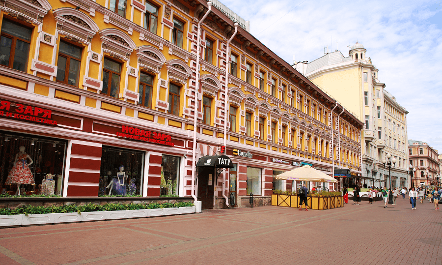
Arbat is a touristy pedestrian street in the Central Administrative District of Moscow (Arbat district). Passes from Arbat Gate Square to Smolenskaya Square lie between Prechistenka and Novy Arbat. The numbering of houses is conducted from the Arbat Gate Square.
Bolshaya Dmitrovka Street (in the early 1920s – Eugene Pottier Street, in 1937-1993 – Pushkinskaya Street) – a street in the Tverskoy district of the Central Administrative District of Moscow. It runs from Okhotny Ryad Street to Strastnoy Boulevard. The numbering of houses begins from Okhotny Ryad street.
Bolshaya Nikitskaya Street (in 1920-1993 – Herzen Street) is a radial street in the Central Administrative District of Moscow. Passes from Manezhnaya Square to Kudrinskaya Square between Tverskaya Street and Vozdvizhenka parallel to them. The numbering of houses begins at Manezhnaya Square.
Bolshaya Ordynka Street is a street in the Central Administrative District of Moscow. It runs from the Maly Moskvoretsky Bridge to Serpukhovskaya Square. The central and oldest street of the historical Zamoskvorechye, the border between the modern municipal districts of Yakimanka (even, western side) and Zamoskvorechye (odd, eastern side).
Bolshaya Yakimanka (in 1956-1992 – Dimitrova Street) is a radial street in the Yakimanka district of the Central Administrative District of Moscow. It runs from Yakimanskaya Embankment to Kaluga Square. The numbering is from Yakimanskaya Embankment. In the 1970s, it was connected to Bolshaya Polyanka Street by a wide Yakimansky passage cut through a grid of old lanes. As a result, the northern segment of Bolshaya Yakimanka turned into a secondary lane.
Boulevard Ring, also Ring A, is a continuous sequence of boulevards and squares in the Central Administrative District of Moscow, totaling 9 km. Includes ten boulevards. Contrary to the name, the ring does not form a closed circle. In the west, it ends at Prechistenskie Gate Square, and in the east – at the Bolshoy Ustyinsky Bridge.
Chistoprudny Boulevard is a boulevard in the Basmanny District of the Central Administrative District of Moscow. Passes from the Turgenevskaya Square and Sretensky Boulevard towards Pokrovka Street, where it adjoins Pokrovsky Boulevard, the numbering is from the Turgenevskaya Square. There is Chistye Prudy Pond on the boulevard.
Europe Square is a square in Moscow, located between Berezhkovskaya embankment, Kievsky railway station and Kievsky (Borodinsky) square, outside the Garden Ring on the banks of the Moscow River. It is located in the Dorogomilovo district of the Western Administrative District.
Garden Ring is a circular arterial system of streets in the center of Moscow. Length – 15.6 km, width – 60-70 m. The Ring consists of seventeen individually named streets and fifteen squares. The Garden Ring is a direct descendant of the Skorodom and Earth Rampart fortifications, respectively.
Gogolevsky Boulevard (until 1924 – Prechistensky Boulevard) is a boulevard in the Central Administrative District of Moscow, part of the Boulevard Ring. The boulevard runs from Prechistenskiye Gate Square to Arbat Gate Square. Numbering is conducted from the Prechistensky Gate Square.
Ilyinka Street (in the XIV-XV centuries – Dmitrovka Street, in 1935-1990 – Kuibyshev Street) – a street in the Central Administrative District of Moscow, on the territory of Kitay-Gorod. One of the oldest streets in Moscow. It runs from Red Square to Ilyinsky Gate Square and lies between Nikolskaya Street and Varvarka. The numbering of the houses begins in Red Square.
Kalanchevskaya Street is a street in the center of Moscow, one of the most important thoroughfares of the Krasnoselsky District, between Lermontovskaya Square and Bolshaya Pereyaslavskaya Street. It was named in the 19th century after the nearby Kalanchevskoye field (now Komsomolskaya Square), the name of which arose in connection with the existence here in the 17th century of the royal traveling palace with a high tower.
Kaluga Square (Kaluzhskaya Ploshchad) is a square on the Garden Ring in Moscow. It connects several streets: Bolshaya Yakimanka approaches it from the north, Leninsky Prospekt (former Bolshaya Kaluga Street) and Mytnaya Street from the south, Krymsky Val from the west, Zhitnaya Street and Koroviy Val from the east.
Kamergersky Lane is a street in the Tverskoy district of the Central Administrative District of Moscow. It runs from Tverskaya Street to Bolshaya Dmitrovka. Since 1998, the lane has been pedestrianized and closed to motor vehicles. The numbering of houses is from Tverskaya Street.
Kudrinskaya Square (from 1919 to 1922 and from 1925 to 1992 – Uprising Square, from 1922 to 1925 – Eugene Pottier Square) – an area in the Presnensky district of the Central Administrative District of Moscow on the Garden Ring between Barrikadnaya, Sadovaya-Kudrinskaya, Bolshaya Nikitskaya and Povarskaya streets, Novinsky Boulevard and Kudrinsky Lane.
Kuznetsky Most Street is a street in the Meshchansky and Tverskoy districts of the Central Administrative District of Moscow. It runs from Bolshaya Dmitrovka Street to Bolshaya Lubyanka Street. The numbering of houses is from Bolshaya Dmitrovka. Kuznetsky Most is one of the oldest streets in Moscow, the appearance of which is associated with the construction of the Cannon Yard in this area.
Lermontovskaya Square (part of the former Krasnovorotskaya Square) is an area in the north-east of the center of Moscow, on the arrow of Novaya Basmannaya and Kalanchevskaya streets. On the third side, the area is limited by Krasnovorotsky passage.
Lesnaya Street (former 3rd Belorussky Proezd) is a street in the Central Administrative District of Moscow, north of the Garden Ring. It runs from Tverskaya Zastava Square to Novoslobodskaya Street, which passes into Palikha Street. The name of the 19th century is given by the timber warehouses and the market at that time, where the timber was stored and sold.
Lubyanskaya Square (including the former Vladimir Gates, in 1926-1990 – Dzerzhinsky Square) is a square in the center of Moscow, not far from Red Square, located between Teatralniy Proezd, Nikolskaya Street, Novaya Square, Lubyansky Passage, Myasnitskaya Street, Bolshaya Lubyanka Street and Pushechnaya street.
Malaya Bronnaya Street is in the Presnensky District of the Central Administrative District of Moscow. It runs from Tverskoy Boulevard to Sadovaya-Kudrinskaya Street (Garden Ring).
Malaya Dmitrovka Street (in 1944-1993 – Chekhov Street) is a street in the Tverskoy district of the Central Administrative District of Moscow. It runs from Pushkinskaya Square to the Garden Ring. The numbering of houses is conducted from Pushkinskaya Square.
Manezhnaya Square (in 1967-1990 – the area of the 50th anniversary of October) is one of the largest squares in the center of Moscow, located next to the Kremlin and Alexander Garden. Created in 1931-1938 during the implementation of the master plan for the reconstruction of Moscow and includes the former Moiseevskaya Square, Obzhorny Lane, Loskutny Lane and a dead end, adjacent parts of Bolshaya Nikitskaya, Manezhnaya, Mokhovaya and Tverskaya streets.
Maroseyka Street (in 1954-1990 – Bogdan Khmelnitsky Street) is a street in the Central Administrative District of Moscow (Basmanny District). Passes from Ilyinsky Gate Square to Pokrovka Street (intersection with Armenian and Starosadsky lanes). The numbering of houses is conducted from the Ilyinsky Gate Square.
Mokhovaya street (1961-1990 – part of Marx Avenue) – a street in the center of Moscow. The street originates from Znamenka Street, goes to the north, connects to Vozdvizhenka Street, connects to Bolshaya Nikitskaya Street, goes to the left and ends at Tverskaya street. The continuation is Okhotny Ryad street. The numbering of houses is from Znamenka.

Myasnitskaya Street (in the 16th-17th centuries – Frolovskaya Street and Evplovskaya Street, in 1918-1935 – Pervomaiskaya Street, in 1935-1990 – Kirov Street) – a street in the Central Administrative District of Moscow (Basmanny and Krasnoselsky districts). Passes from Lubyanskaya Square to Sadovaya-Spasskaya Street (Garden Ring). The numbering of houses begins from Lubyanka Square.
Neglinnaya Street (until 1922 – Neglinny Proyezd) is a street in the Central Administrative District of Moscow. It runs from Teatralny Proezd to Trubnaya Square. The numbering of houses is conducted from the Teatralny proezd. Until 1922, the street was called Neglinny proezd, along the Neglinnaya River, on the line of the new channel of which the street was formed in the 19th century.
New Arbat Avenue (Novy Arbat, in 1963-1990 part of Kalinin Avenue) is a street in the Arbat district of Moscow. It continues Vozdvizhenka Street from Arbat Gate Square and goes to Svobodnaya Rossiya Square, where it passes into the Novoarbatsky Bridge. Part of the federal highway M-1 (Vozdvizhenka Street – Novy Arbat – Kutuzovsky Prospekt – Mozhayskoye Highway – Minskskoye Highway).

Nikitsky Gate Square, Nikitsky Gate (name from the 18th century), is a square in the Presnensky district in the Central Administrative District of Moscow. The square is located at the Boulevard Ring and Bolshaya Nikitskaya Street intersection. The name of the square, as well as the adjacent boulevard and streets, comes from the Nikitsky Gate, one of the 11 gates of the White City.
Nikolskaya Street – a street in the Tverskoy district of the Central Administrative District of Moscow, one of the main streets of Kitai-Gorod. Passes from Red Square to Lubyanka Square. The numbering of houses starts from Red Square. Nikolskaya is one of the oldest streets in Moscow. The Printing Yard, the Nikolo-Greek Monastery (Nikola Stary), the Slavic-Greek-Latin Academy, and the Military Collegium of the Supreme Court of the USSR were located here at different times.
Novaya Basmannaya Street (in 1918-1922 – Kommuny Street, in the 17th century – Kapitanskaya Slobidka) is a street in the Central Administrative District of Moscow. Separates Basmanny and Krasnoselsky districts. It runs from Lermontovskaya Square on the Garden Ring to Razgulay Square.
Ostozhenka Street (in 1935-1986 – Metrostroevskaya Street) is a street in the Central Administrative District of Moscow. The name was given in the 17th century after the ancient tract of Ostozhye. Passes from Prechistenskiy Gate Square to Krymskaya Square, between Prechistenka and Prechistenskaya Embankments. The numbering of houses is conducted from Prechistensky Gate Square.

Paveletskaya Square is a square in the center of Moscow on the Garden Ring near the Paveletsky railway station. It is located in the Zamoskvorechye district. From 1922-1941, it was called Saratovskaya Square; from 1941 to 1992 – Leninskaya Square. In 1992, it was named Paveletskaya Square after the Paveletsky Station, which is in front of it. At the same time, the former Leninsky passage was included in the square, limiting it from the east.
Petrovka Street is one of the main and oldest streets in the center of Moscow. It is in the Central administrative district of the city in the territory of the Tverskoy district. Passes from Theater Square (the beginning of the numbering of houses) to Sredny Karetny Lane.
Pokrovka Street (in 1940-1992 – Chernyshevsky Street) is a street in the Central Administrative District of Moscow. Passes from the Armenian lane to Zemlyanoy Val Square (Garden Ring). It continues on Maroseyka Street and lies between Myasnitskaya and Vorontsovo Pole streets. Crosses the area of the Pokrovsky Gates.

Pokrovsky Boulevard is a boulevard in the Basmanny District of the Central Administrative District of Moscow. It was named after Pokrovka Street and the Pokrovsky Gates of the White City—part of a Boulevard ring. It runs from Khokhlovsky Square (Khokhlovsky Lane) in the north to Vorontsovo Pole Street (Yauzsky Boulevard) in the south.
Ploschad Revolyutsii (Revolution Square, until March 1917 – Voskresenskaya Square) is one of the central squares of Moscow. Located on the territory of the Tverskoy district between Manezhnaya and Teatralnaya squares.
Prechistenskye Vorota Square (in 1924-1993 – Kropotkinskaya Square) – is part and, in fact, the beginning of the Boulevard Ring between Volkhonka, Prechistenka, Ostozhenka, Soymonovsky passage and Gogolevsky Boulevard in Moscow. The metro station “Kropotkinskaya” is located on the square.
Pyatnitskaya Street is one of the oldest streets of Zamoskvorechye in the Central District of Moscow. It starts in the north near the Vodootvodny Canal near the Chugunny (Iron Cast) Bridge, being a direct continuation of Balchug Street, and goes south to Serpukhovskaya Square.

Pushkinskaya Square is located in the Central Administrative District of Moscow between Tverskoy and Strastnoy Boulevards (Boulevard ring), separated by Tverskaya Street, one km northwest of the Kremlin and Red square. The historical name is Strastnaya Square (after the Strastnoy Monastery), otherwise Tver Gate Square (along the Tver Gates of the White City). It received its current name in 1931.
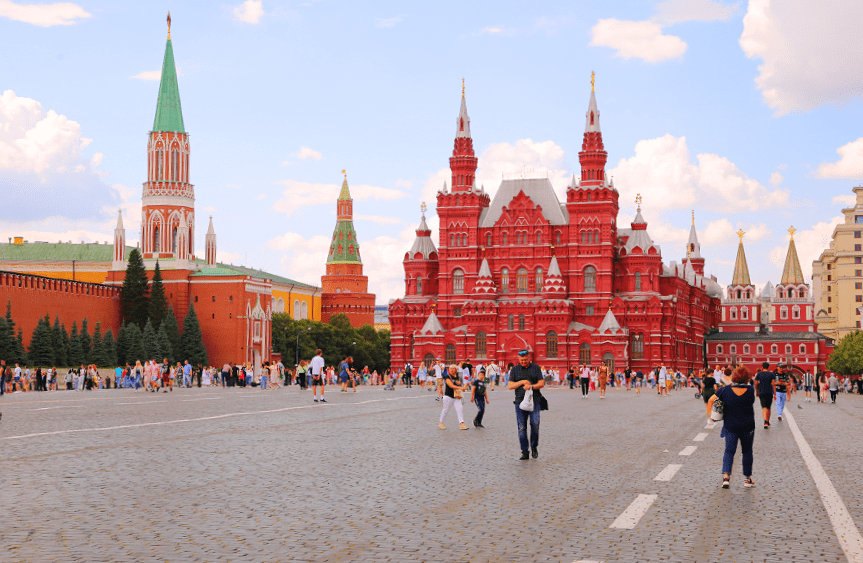
Red Square is the main square of Moscow, located between the Moscow Kremlin (to the west) and Kitay-Gorod (to the east). It goes to the bank of the Moskva River through the gentle Vasilyevsky Spusk. The square stretches along the northeastern wall of the Kremlin, from the Kremlin passage and the Voskresenskiye Gates passage to Vasilyevsky Spusk, overlooking the Kremlin embankment.
Rozhdestvenka Street (in 1948-1989 – Zhdanova Street) is a street in the Meshchansky District of the Central Administrative District of Moscow. It runs from Teatralny Proezd to Rozhdestvensky Boulevard and lies between Neglinnaya Street and Bolshaya Lubyanka parallel to them. The numbering of houses is conducted from the Teatralny proezd.

Rozhdestvensky Boulevard is a boulevard in the Meshchansky District of the Central Administrative District of Moscow, part of the Boulevard Ring. It runs from Trubnaya Square in the west to Sretensky Gate Square in the east.
Sadovnicheskaya Street is a street in the Zamoskvorechye district of Moscow. Passes between Balchug Street and Nizhnyaya Krasnokholmskaya Street (Garden Ring) along the middle line of the island between the Moscow River and the Vodootvodny Canal.
Sretenka (in the 16th century, Ustretenskaya Street) is a street in the Krasnoselsky and Meshchansky districts of the Central Administrative District of Moscow. It runs from Sretensky Gate Square to Bolshaya and Malaya Sukharevskaya Squares. The numbering of houses is from the Sretensky Gates. It serves as part of the northeastern transport beam, the beginning of which is Bolshaya Lubyanka, and the continuation beyond the Garden Ring is Prospekt Mira and Yaroslavl Highway.
Sretensky Boulevard is a street in the Krasnoselsky District of the Central Administrative District of Moscow, part of the Boulevard Ring. Passes from Sretensky Gate Square to Turgenevskaya Square. From the inside, the lanes Milyutinsky and Frolov adjoin the boulevard, from the outside – Kostyansky.
Stoleshnikov Lane (in the 16th-17th centuries – Rozhdestvenskaya Street, in the 18th-19th centuries part of it – the former Kosmodamiansky Lane) is a lane in the Central Administrative District of Moscow. It runs from Tverskaya Square to Petrovka Street, crosses Bolshaya Dmitrovka, and runs parallel between Tverskoy Proyezd and Kamergersky Lane, further turning into Kuznetsky Most Street.
Taganskaya Square is a square on the Garden Ring, the center of the Tagansky district of the same name in the Central Administrative District of Moscow. It was formed in 1963 by merging the previously isolated Upper and Lower Tagansky squares, connected by the Tagansky passage (in the 19th century – Tagansky Market Street).
Teatralnaya Ploschad (Theater Square, 1820s – Petrovskaya Square, in 1824 already Teatralnaya, in 1919-1990 – Sverdlov Square) – a square in the center of Moscow. It is located northwest of Revolution Square, between Teatralny Proyezd, Petrovka and Kopyevskiy Lane.
Teatralniy proezd (Theatre passage, 1961-1990 – part of Marx Avenue) – a street in the Central Administrative District of Moscow. It runs from Theatre Square to Lubyanka Square. The numbering of houses is carried out from the Theatre Square.
Tretyakovskiy proezd is a street in Moscow, located in the historical Kitay-gorod district between Nikolskaya street and Teatralniy Proezd. It was built in 1870-1871. At the same time, the Tretyakov Gates, stylized as Russian antiquity, were cut through in the Kitaigorodskaya wall next to the Bird Tower.
Triumfalnaya Square (in 1935-1992 – Mayakovsky Square) – a square in the Tverskoy district of the Central Administrative District of Moscow on the Garden Ring between Bolshaya Sadovaya, 1st and 2nd Brestskaya, 1st Tverskaya Yamskaya Street, Armory Lane, Sadovaya-Triumfalnaya and Tverskaya Streets.
Trubnaya Square is on the Boulevard Ring, the Central Administrative District of Moscow. Petrovsky Boulevard, Rozhdestvensky Boulevard, Neglinnaya Street, Tsvetnoy Boulevard and Trubnaya Street overlook the square. From 1590 to 1770, the wall of the White City passed here, in which there was a blind tower – without a gate. Near the tower, a hole was made for the Neglinnaya River flowing here, covered with a grate.
Turgenevskaya Square is a square in the center of Moscow, part of the Boulevard Ring between Myasnitskaya Street, Frolov Lane, Sretensky Boulevard, Academician Sakharov Avenue and Myasnitskiye Vorota Square. Located in the Krasnoselsky district. The metro station “Turgenevskaya” is located on the square.
Tverskaya Street is the main street of Moscow in the Tverskoy district of the Central Administrative District. It runs from Manezhnaya Square to Triumphalnaya Square. The street originated as a road to Tver, a section of which within the boundaries of Moscow, from the Iversky Gates of the Kitay-gorod Wall to the gates of the Earthen City, was called Tverskaya Street. Tverskaya Street was significantly expanded and rebuilt in the first half of the 20th century. From 1932 to 1990, 1st Tverskaya-Yamskaya Street was Gorky Street, named after the Soviet writer Maxim Gorky.
Tverskaya Zastava Square (after 1834, also New Triumphal Gate Square, 1932-1990 – Belorussky Station Square, including New Triumphal Gate Square, Brestsky Lane and Brestsky Proyezd) – an area on the border of the Central and Northern administrative districts of Moscow. It separates 1st Tverskaya-Yamskaya Street and Leningradsky Prospekt. On the square, there is the Belorussky railway station, the Tverskaya Zastava square, the Belorusskaya metro station of the Koltsevaya line and the Belorusskaya station of the Zamoskvoretskaya line, the Tverskoy overpass.
Tverskoy Boulevard is a boulevard in the Central Administrative District of Moscow, the oldest and longest on the Boulevard Ring. Passes from Nikitsky Gate Square to Pushkinskaya Square. On the left, Malaya Bronnaya Street, Bogoslovsky, and Sytinsky lanes adjoin the boulevard, and on the right – the Swedish dead end. The numbering of houses is conducted from the Nikitsky Gate Square.
Verkhnyaya Radishchevskaya Street (until 1919 – Verkhnyaya Bolvanovka Street) is a large street in the center of Moscow in the Tagansky District from Yauzskaya Street to Taganskaya Square.
Vozdvizhenka Street (in 1935-1946 – Komintern Street; in 1946-1962 – Kalinina Street; from 1963 to the early 1990s – part of Kalinin Avenue) – a street in the Arbat district of the Central Administrative District of Moscow. It runs from Manezhnaya Street to Arbat Gate Square and is located parallel to the Znamenka and Bolshaya Nikitskaya Streets.
Yauzsky Boulevard is a boulevard in the Tagansky district of the Central Administrative District of Moscow, the last (eastern) link of the Boulevard Ring. It runs from Vorontsovo Pole Street and Podkolokolny Lane in the north to Yauzskiye Vorota Square in the south. The numbering of houses is carried out from Vorontsovo Pole Street.