Argelès-sur-Mer [fr. Argelès-sur-Mer, cat. Argelers de la Marenda], or simply, Argelers is a village and a community of about 10 000 inhabitants, in the region of Roussillon, in North Catalonia (Pyrénées-Orientales, Occitania, France).
It’s a popular part of the Vermillion coast of the Mediterranean resorts of France.
Currently, together with the towns of Collioure and Port-Vendres and the villages of Banyuls de la Marenda, Cervera, Palau del Vidre and Sant Andreu de Sureda, they form the cantó number 5 of the Côte Vermeille (new group of municipalities resulting from the cantonal restructuring made on the occasion of the cantonal and departmental elections of 2015), with capital in Argelers.
At the end of the Spanish Civil War, in 1939, Argelers sadly became famous for the concentration camp that the French government installed on its beach, where up to 100,000 Republican exiles from Spain were interned.
The saying goes: A la Roca el sol hi toca, a Argelers encara més i A Cotlliure, hi fa bon viure, i a Argelers, si tens diners i A Portvendres, piquen pebre, | a Argelers, piquen sal: | l’alegria de les dones | és sota del davantal (english: The sun touches La Roca, Argelers still more, in Collioure it is good to live, and in Argelers, if you got the money and at Port-Vendres, they chop pepper, | in Argelers, they chop salt: | joy of women | is under the apron.

Tourism and main sights
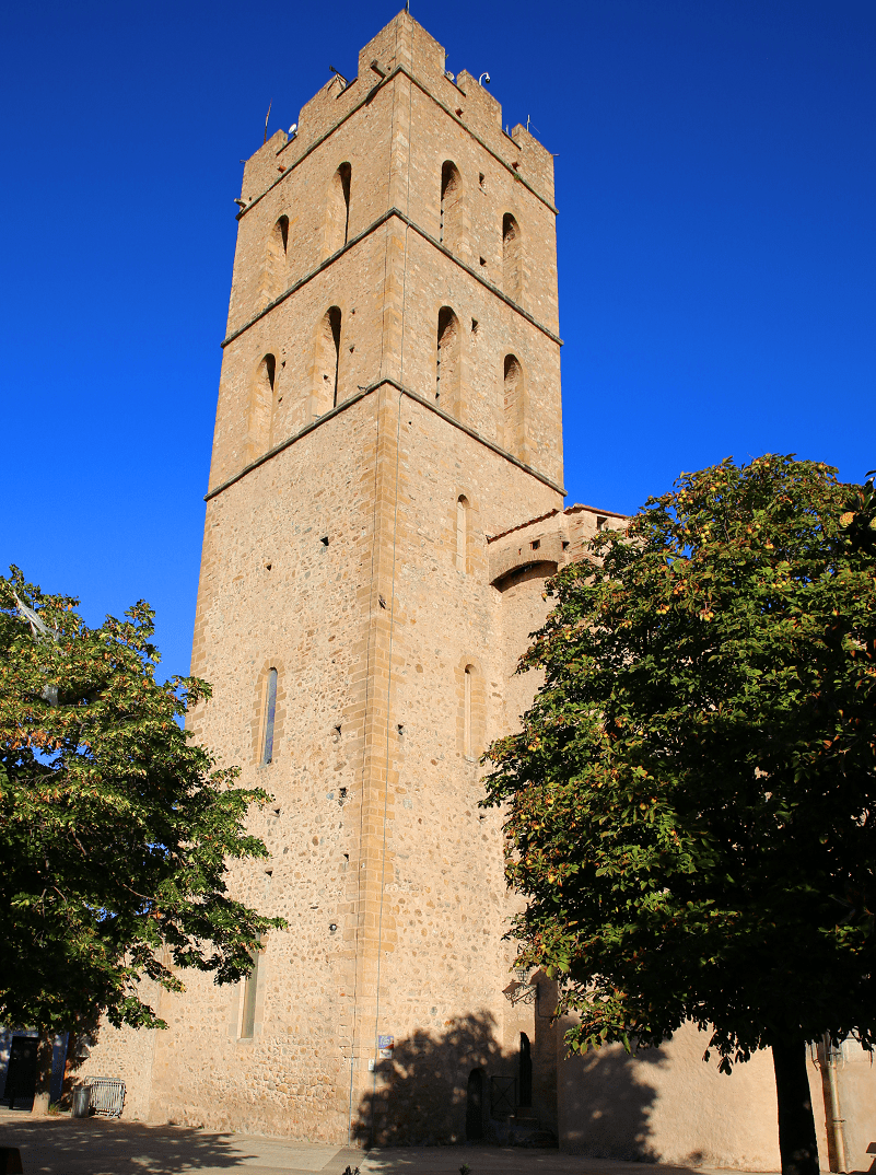
Located at 10 m altitude, Argelers preserves a part of its medieval layout, with the remains of the city walls. The old town is on the right side of La Maçana, it has the structure of a medieval village. At the southern end of the old enclosure there is the parochial church of Our Lady of Prado, of Romanesque origin, but redone in the 14th century, already in the Gothic. In the old town stands out the building called Amorós Castle.
The old town underwent expansion in two directions: the Marrasquer district, to the east and Arpa, to the west. Later extensions of the town were the neighborhoods of Castell Meler, Esportes, La Torreta, Sant Pere, la Clapera and the Voramars, as well as other neighborhoods that were raised in the lands of former farmhouses in the areas surrounding the town.
Those farmhouses are nowadays disappeared almost entirely. Already in the late 20th century, new neighborhoods were created, in fact residential areas, including: Ametllers, Camp de Cadaqués, Camps del Palau, Cassines de la Verneda, Jardins du Soleil, Mas Boi, Mas d’en Botte, Mas Mosser, Mas Pantós, Mas Roca and others. The Zone Artesana houses the main industrial and commercial activities of Argelers. All this has extended Argelers far beyond what was the original town.
To the south of the town is the Station of Argelers, commonly called Gara, as well as two cemeteries, the New and the Old. While the cementeri of the Spanish, with those who died in Camp d’Argelers, is to the northeast of the town and to the south of the neighborhood of the Platja d’Argelers.
There are no vestiges of the church of Sant Julià de Roar or de Garriga, mentioned as a parish in 1178 (parish of Sancti Juliani de Garriga). It was located within the area of Roar, in the west of the territory, but the exact location is unknown.
West of the town of Argelers the place name of Sant Pere is conserved as a name of a modern neighborhood. There are, however, no vestiges from the church that gave it this name. It was, however, mentioned in written records in 981 (Villa Sancti Petri juxta villam Argalariam) and in 1068 (Sancti Petri vel Sancti Laurentii de Argeles).
Main sights (list)
- Dolmen of the Collets de Cotlliure (Monument historique)
- Dolmen of the Cova de l’Alarb (Monument historique)
- Dolmen of Sant Pere dels Forquets
- Chapel of Saint-Jérôme d’Argelès, from the 10th century
- Church of Saint-Ferréol de la Pava (Monument historique), from the 10th century
- Parish church of Notre-Dame del Prat, from the 14th to the 20th centuries (Monument historique)
- Church of Sainte-Marie de Torreneules, from the 8th to the 10th centuries
- Abbey of Valbonne, from the 13th to the 14th centuries
- Church of Saint-Laurent-du-Mont, from the 12th century (Monument historique)
- Church of Saint-Martin-et-Sainte-Croix, from the 11th or 12th century, and the old village of Taxo d’Avall (both Monument historique)
- Church of Saint-Pierre dels Forquets, pre-romanesque ruins
- Castle of Pujols, from the 13th century (Monument historique)
- Massane tower, in the Albera Massif, from the 13th century
- Castle of Valmy, from the 19th century
- Casa de l’Albera, museum about the Albera Massif
Beaches
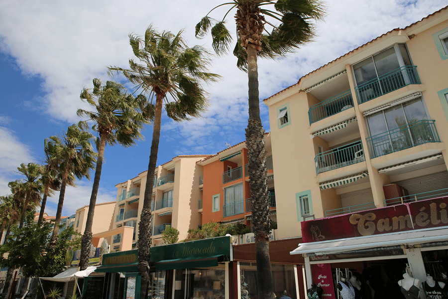
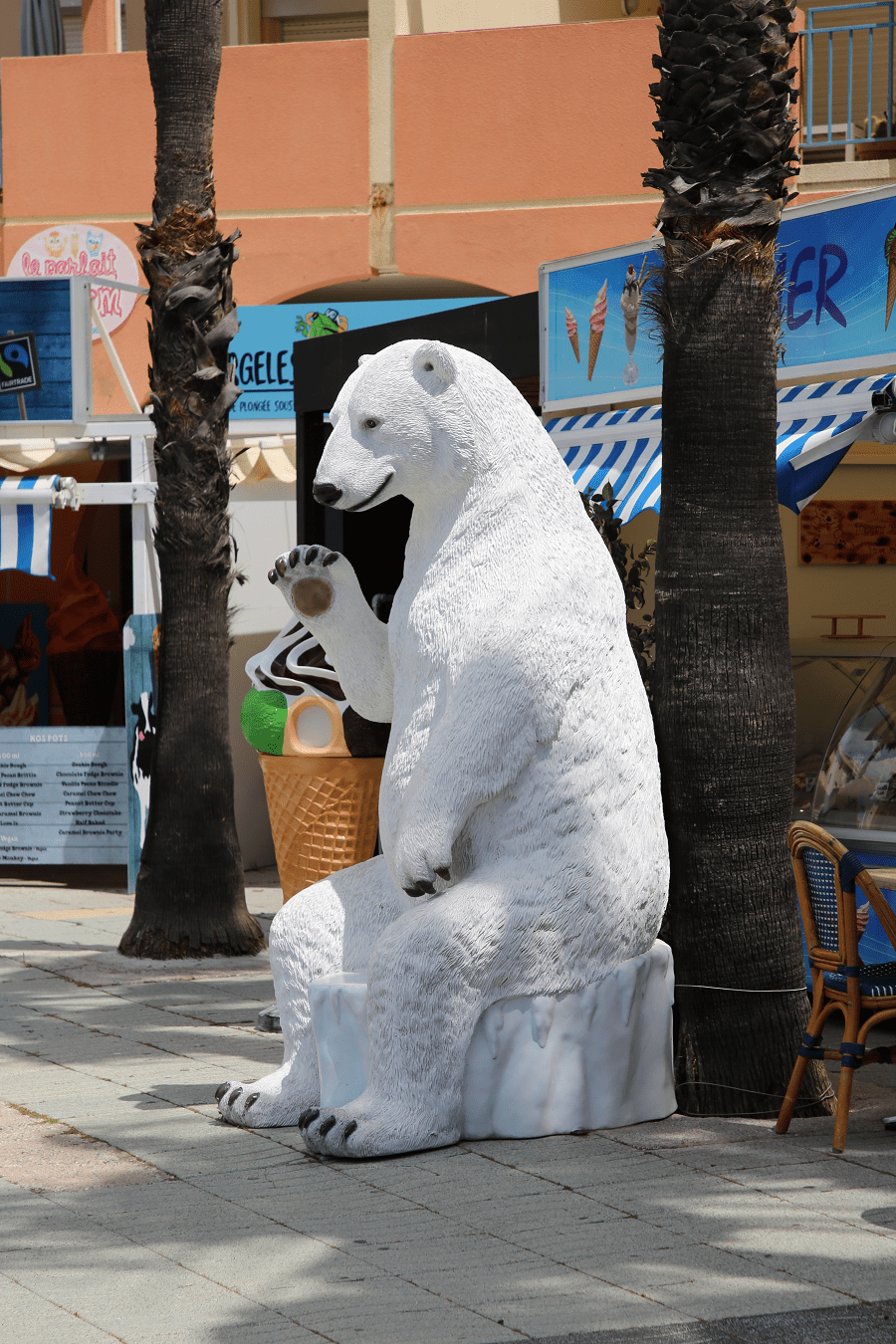
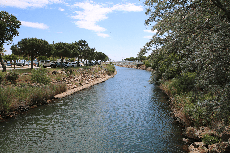
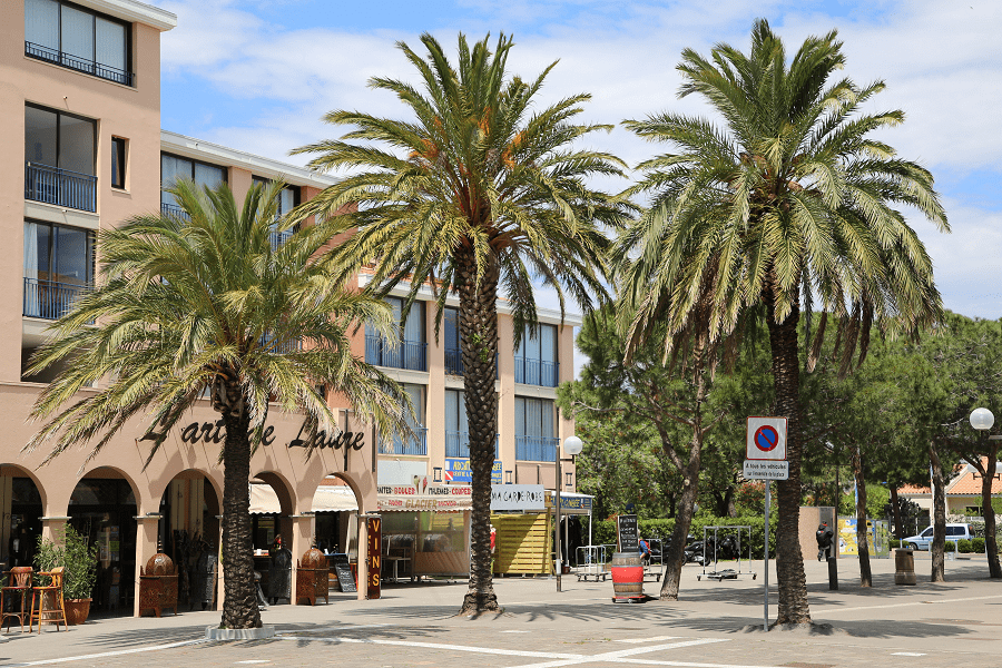
Argelès Plage is a modern town, that emerged with the rise in tourism. In the Napoleonic Cadastre census of 1812 it had no more than a coastal defense artillery battery. It stretches about 3 kilometers on the coastal strip, next to the Plage du Pinos beach, where pinewoods reach almost to the water. They are pine trees that were planted a century ago and nowadays make up the coastal landscape of Argelers. Apartment blocks alternate with tourist services, and there is a modern chapel of Our Lady of the Estrella del Mar, with stained glass windows of Willy Mucha. Part of this modern town extends over the field where the Camp d’Argelès-sur-Mer was located.
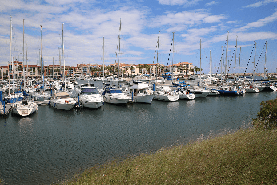
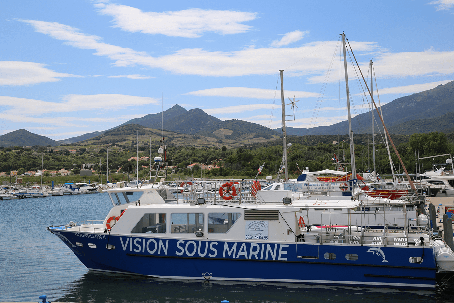
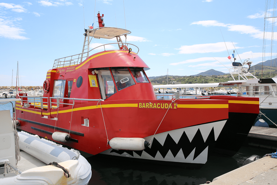
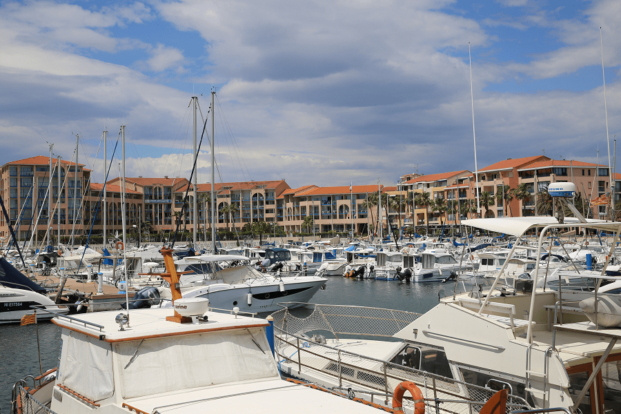
The Port of Argelers, newly built as a marina, between the Argelès Plage, which is to its north, and Le Racou, to the south, replaces the old Grau de la Maçana, dedicated to fishing. It is on the bay of Maçana. It also does not appear in the Napoleonic Cadastre of 1812.
Le Racou, located between the Grau de la Maçana and Cala del Portell, formed a second tourist centre of the Argelès-sur-Mer. Called le Racou, it is made up of summer houses, some permanent residence homes, a few of them scattered through various coves and areas on the coast. It also does not appear in the Napoleonic Cadastre of 1812. Just at the southern end of the current neighborhood there had been a coastal defense artillery battery.
Prehistory
A legend says that Argelès-sur-Mer was founded by Hercules. The presence of two dolmens and bones indicates that the territory of the municipality has been occupied by humans since prehistory. Between Mas de Sant Jordi and Mas d’en Frere or Valmy, near the Coma Fosca, there is a well preserved dolmen of the Cova de l’Alarb. Two other dolmens are found in the Collets of Collioure (Dolmen des Collets de Cotlliure) and in Sant Pere dels Forquets, as well as a prehistoric bone from the Metal Age in the Turtle Cave.
In the area of the Necrópolis de la Pava, explained below, numerous vestiges from the Bronze Age were found, as well as some from the Iron Age, which led to the conclusion of the existence of a fairly important settlement, which occupied around 2,000 m². From the same time, the late Bronze, is the small settlement discovered through many remains found in Inveny, very close to the south part of the town of Argelers, on the other side of the dual carriageway that surrounds it.
In the Ravaner valley, at the far end of the territory, bordering with Collioure, a complex habitat was found, with a human activity presence from the late Bronze Age until the end of the of the Iron Age. In La Pava, on the northeastern side of El Puig de Sant Miquel, a late Bronze habitat was also found. From the protohistoric times, from the transition from prehistory to protohistory, dates the Necropolis of La Pava, located north of Mas d’en Torrents, and further north of Pava. It includes burial urns, as well as numerous artifacts, among them Iberian amphorae, Roman tiles, African amphorae, etc. which represent a settlement in continuity from prehistory to late medieval times.

Ancient History
Roman colonization is perhaps that which has left most remains in Argelers. At the northern end of the territory, on the left bank of the Tech river and near the south of the chapel of Santa Eugenia de Tresmals, sufficient remains were found (tiles, amphorae, African amphorae, ceramics, etc.) to be able to speak of a Roman settlement. It is a site located just between the two neighboring areas, of Elna and Argelers. Also some medieval remains were found there, which tells us there was a continuity of the settlement over several centuries. In addition, one avenue of Tech in the 60s uncovered a wide area with remains of walls that could correspond to a medium or large establishment, or one of the stations of Via Domitia and the route itself.
South of the Mas Calmetes, on the left bank of the Tech, along the stretch of communal terrain that extends to the north of this river, a Roman cistern was found above the sand, made with tile mortar, with two stone lids at the ends and one in the middle. In its surroundings, numerous fragments of amphoras and other ceramics were found. Very possibly it is a wine or oil cistern. In Gavarretes and Colomina dels Aspres, in the north of the central part of the municipality, a little to the southeast of the remains described above, there were numerous remains found that correspond to an occupation of the late Roman Empire, or posterior. A little more south, in northern Negabous, Spanish vestiges appeared from the same time as mentioned before.
In the Camp del Cavall, on the western edge of the municipality and on the northeast of the large crossing of highways of the west entryway to the city of Argelers, a large concentration of remains from the Roman Republican period makes it clear that there was a large settlement, or several ones, in this place. The construction of new roads and communication knots in the area strengthened the hypothesis of an area of intense Roman population. Several Roman coins were found, too.

In the surroundings of Pujols Castle, while soil was extracted on a private property, a small treasure appeared which included about 300 Roman coins. To the west of Aspres du Pujols, near the north of the town of Argelers, numerous vestiges, of the same periods as mentioned before, were also found.
In the Mas Llinars, previously mentioned, remains from Roman republic also appeared, that indicates the presence of a settlement.
At the far east of the Argelers district, in the southeast of the Racó, there is the Olla site, above the Platja de l’Olla, which borders with Collioure, at the mouth of the Ravaner. On the site there was a considerable amount of traces found, at different levels, they included fragments of greco-lithic, itatic and iberopianic amphores, with numerous remains of ceramics, all attributable to the second century before our era. The set allows us to deduce a nearby metallurgical activity, with a settlement associated with the coast.
A small settlement of the late antiquity, with numerous remains in the surrounding area, was found in La Pava, in the vineyards of the entrance to the valley of La Maçana and at the bottom of the valley near the village, where the old road that went over the valley used to pass. Nearby, on the site called Mas Torrents nord, a Roman settlement was discovered, with an area of about 4,000 m², east of an ancient path, where vestiges of all kinds were found: fragments of tegulae, amphoras of various origins, homemade ceramics, etc., that allowed to date the site to the 1st and 2nd centuries of our era. The found artifacts are exhibited at the Casa de l’Albera in Argelers.
In the neighboring Mas Llinars, to the northwest of Mas Torrents, the owners also preserve a lot of remains found in their land, including coins, of the late Empire. In a nearby area, on the lower part of the valley, there was also a Greek drachma of Empúries found. Four more also appeared in a place between Coll Terrers and Coll de la Carbassera and another one made in Morvedre appeared in another place near Coll de la Carbassera. Other coins, in this case roman ones, were found in the Torre de la Maçana, in the Barraca de las Ginestes and in the vicinity of Coll de la Carbassera.
From the time of transition from late antiquity to the Middle Ages, dates a site found in the Gavarretes, in the vicinity of the road junction of the D-914 and the D-114, close to the south of Tatzó d’Avall. It is a necropolis occupied at the time previously mentioned, but that also revealed remains from the bronze and iron age, with several circular fossos.
Middle Ages
The first written record of Argelers goes back to 879 when it was mentioned as “Villa de Argilariis”. The name can be found in the 10th century with the forms “Argelarium, Argelaria or Argileria”. It was always a direct dependence of the counts of Rosselló, and as such it directly passed into the hands of the kings of the houses of Catalonia, Aragon and Majorca. In 1298 it was already a fortified town, and in 1344 it was besieged by Peter III the Ceremonious, when he vassaled with the Kingdom of Majorca, at the end of this ephemeral kingdom. In the 15th century it was besieged by the French king Louis XI.
The archaeological surveys have kept bringing to light various elements of the medieval past of Argelers and its area, as well as some older ones, like the settlement of the late Bronze Age. In La Pava, in the northeastern part of Puig de Sant Miquel and about 300 meters northeast of the Castle of Ultrera, a large Visigoth settlement was found, dating from the mid-century to the first century of our era, with a partial restructuring of the site in the 10th century, and a quarry in which 13 fragments of African amphorae appeared.
Modern Times
In 1793, during the War of the Pyrenees, Argelers again suffered a siege, this time by the Spanish troops of General Ricardos, which was answered by the French troops of General Dugommier, who expelled the Spaniards.
Contemporary Ages
In 1939, at the end of the Spanish Civil War, the French authorities closed tens of thousands of refugees fleeing from Spain in Camp d’Argelers, a concentration camp, built to the north of the beach of Argelers. Hygienic conditions and treatment by the French authorities were denigrating. The excess number of inmates led to the construction of the Camp del Barcarès, where part of the inhabitants of Argelers were moved.
Shopping
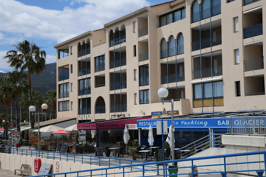
Main shopping area is situated in the borders of the old part of the city and Argelès Plage.
Restaurants
Among the best (Michelin) restaurants of the city are: La Bartavelle (29-55 euro), Le Coup de Fourchette du Cayrou (28-52 euro), Auberge du Roua (34-64 euro).
How to get to?
Shortest distances by car:
From Paris (tolls): 8 hr 31 min (875 km) via A71 and A75
From Biarritz (tolls): 5 h 11 min (535 km) via A64 and A61
From Dax (tolls): 5 h 3 min (501 km) via A64 and A61
From Nantes (tolls): 7 h 32 min (815 km) via A62
From Saumur (tolls): 7 h 34 min (774 km) via A62
From Bordeaux (tolls): 4 h 42 min (475 km) via A62 and A61
From La Rochelle (tolls): 6 h 16 min (652 km) via A62
From Toulouse (tolls): 2 h 24 min (233 km) via A61 and A9
From Carcassonne (tolls): 1 h 33 min (142 km) via A61 and A9
From Monaco (tolls): 5 h 20 min (525 km) via A8 and A9
From Nice (tolls): 5 h 11 min (502 km) via A8 and A9
From Cannes (tolls): 4 h 56 min (475 km) via A8 and A9
From Saint-Tropez (tolls): 4 h 55 min (448 km) via A9
From Marseille (tolls): 3 h 23 min (345 km) via A9
From Avignon (tolls): 2 h 40 min (272 km) via A9
From Montpellier (tolls): 1 h 57 min (184 km) via A9
From Béziers (tolls): 1 h 20 min (122 km) via A9
From Perpignan: 27 min (23.6 km) via D914
From Narbonne (tolls): 1 h 5 min (92.3 km) via A9
From Andorra: 3 h 12 min (193 km) via N116
Main information
Area: 58.07 sq. km
Coordinates: 42°32′42″N 3°01′25″E
Population: 10 340
Language: French, Catalan
Currency: euro
Visa: Schengen
Time: Central European UTC +1
See here best sea and ocean resorts of France and Spain (223 objects)
See here Pyrenees travel guide
See here France travel guide
See here Spain travel guide