Saint-Cirq-Lapopie (in Occitan Sent Circ de la Pòpia) is a commune, located in the south of the Lot department in the Occitania region, in Quercy (France, Massif Central).
It is also in the Gramat Causse, the largest and wildest of the four Quercy Causses.

Exposed to an altered oceanic climate, it is drained by the Lot and various other small rivers. Included in the Causses du Quercy regional natural park, which has had the Unesco global geopark label since 2017, the town has a remarkable natural heritage: a Natura 2000 site (the “lower middle valley of the Lot”), a protected area (the national nature reserve of geological interest of the Lot department) and five natural areas of ecological, fauna and flora interest.
Saint-Cirq-Lapopie is a rural commune that has 203 inhabitants as of 2021, after having experienced a population peak of 1,461 in 1861. It is part of the Cahors catchment area. Its inhabitants are called the Saint-Cirquois or Saint-Cirquoises.
Saint-Cirq-Lapopie is on the French pilgrimage route, Way of St. James. Coming from Cabrerets, pilgrims would pass through and then continue to Cahors, visiting St. Stephen’s Cathedral.
It is a member of the The Most Beautiful Villages of France association.
Main attractions
Religious Heritage
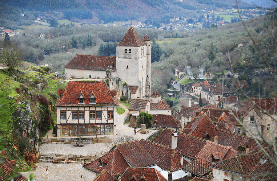
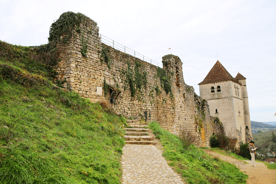
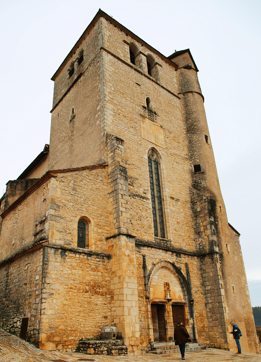
- The Saint-Cirq-et-Sainte-Juliette church, a powerful 15th century church having preserved the Romanesque apse of the castle chapel, square keep and staircase turret. The building was classified as a historic monument in 1911.
- Lower chapel of the Stations of the Cross of Saint-Cirq-Lapopie.
- Chapel of the Mariners of Saint-Cirq-Lapopie.
- Chapel of the Saint-Cirq-Lapopie cemetery.
- Chapelle Sainte-Croix de Saint-Cirq-Lapopie: at the top of a station of the cross planted with boxwood, this 19th century chapel, rebuilt in 1854 on the site of the old church, recalls that the relics of the True Crosses were brought back from the Holy Land by Géraud de Cardaillac.

Civil heritage
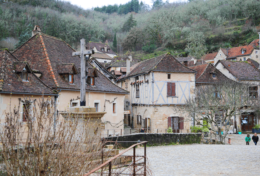
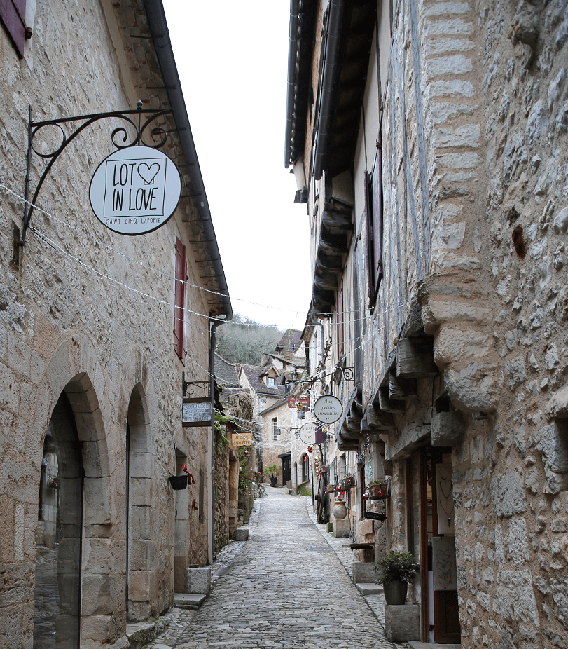
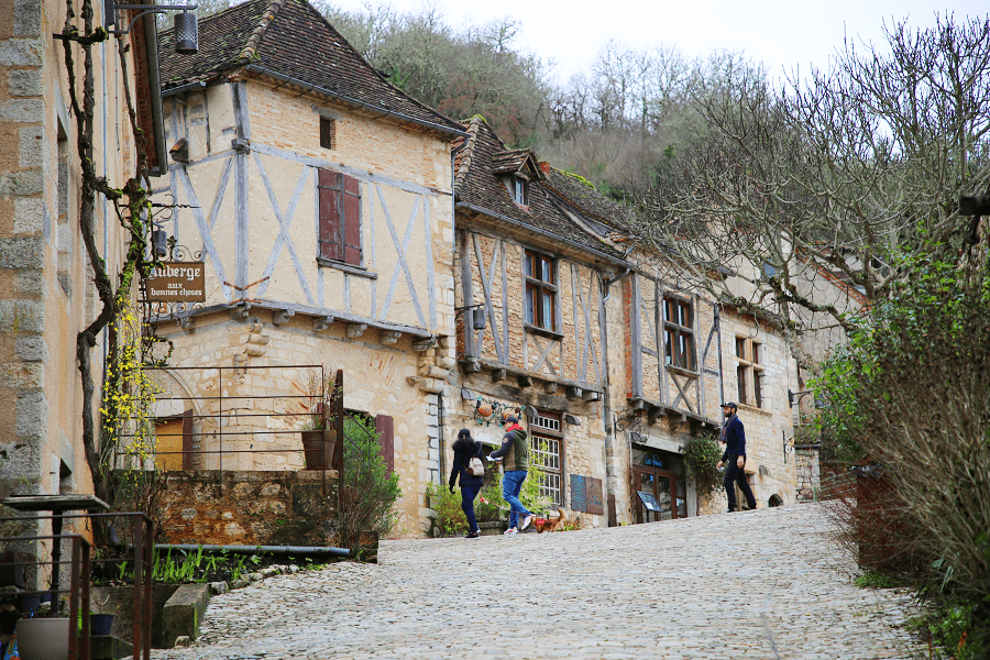
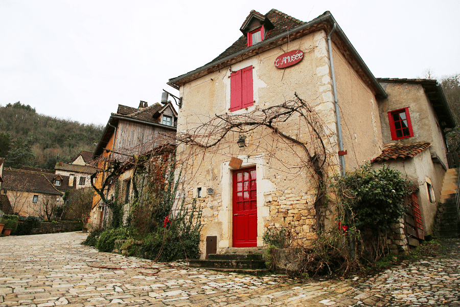
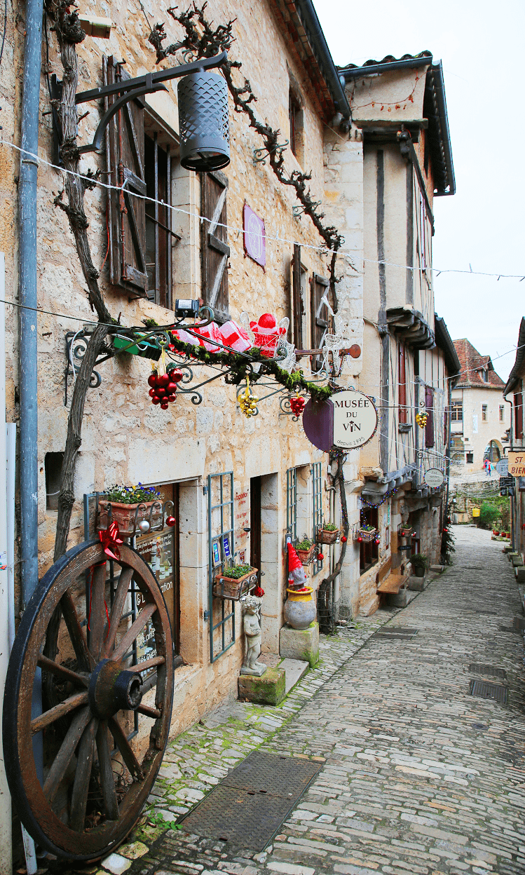
One of the most touristy places in the Lot, Saint-Cirq-Lapopie is an almost entirely listed museum village and well known to artists, including André Breton, who bought and settled in the old Mariners’ Inn in the 1950s.
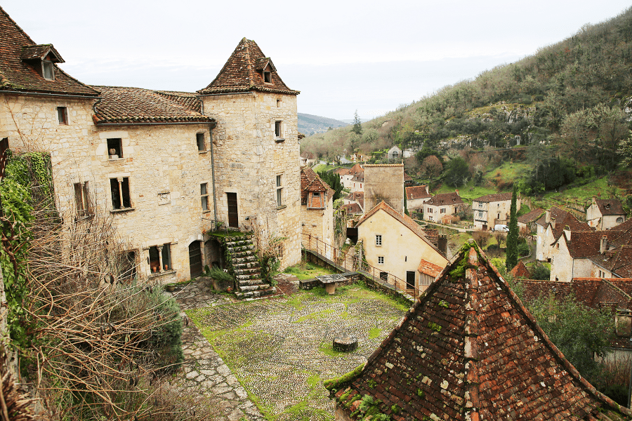
- At the top of the plateau, ruins of three castles and the Saint-Cirq-et-Sainte-Juliette church.
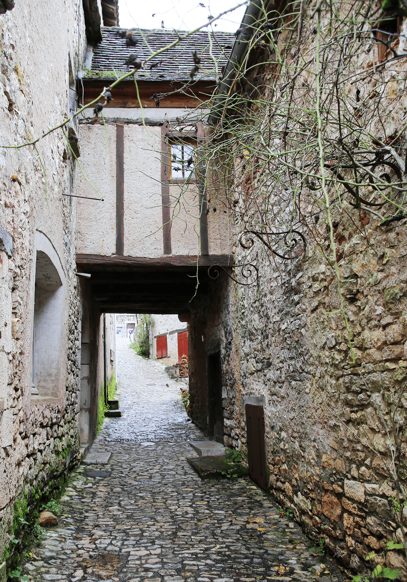
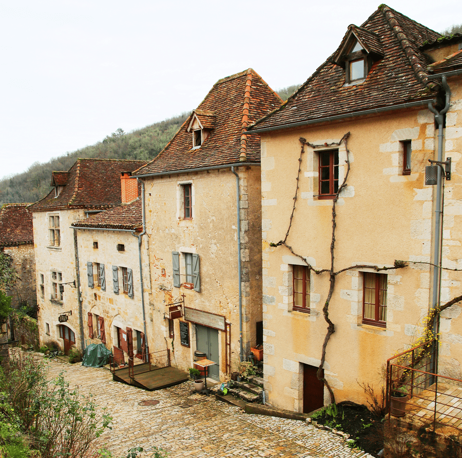
- Steep and narrow streets, with medieval houses from the 14th century with corbels and pointed roofs.
- Rignault Museum, where temporary exhibitions of contemporary art take place. Émile-Joseph Rignault (1874-1962), art enthusiast and collector, donated it in 1946 to the Lot general council.
- The Maisons Daura, residences of the painter Pierre Daura, offered by his daughter Martha to the Midi-Pyrénées regional council for the installation of an artists’ residence and an exhibition space, are now dedicated to Contemporary Art.
- Belvedere of the Vènes cirque: a small iron cross marks access to the viewpoint over the Tour-de-Faure plain and the Vènes cirque of cliffs.

- Bancourel Belvedere: at the foot of a 16th century circular dovecote, the Bancourel esplanade offers a spectacular view of the Lapopie rock and the Aulanac lock. Next to it, you can see the Bancourel dovecote listed as a historic monument in 2010.
- Aulanac lock and mill: below the cliffs, on the edge of the river, old mill from the beginning of the 14th century, associated in the 19th century with a lock and its lock keeper’s house. The stone and half-timbered building is juxtaposed with the old and traditional village factory, that of wooden taps.

How to get to?
From Paris: 5 hr 50 min (578 km) via A20
From Cahors: 31 min (25.6 km) via Rte de Saint-Cirq-Lapopie
From Toulouse: 1 hr 42 min (126 km) via A62 and A20
From Andorra: 3 hr 54 min (307 km) via A20
From Barcelona: 4 hr 58 min (517 km) via AP-7 and A61
From Madrid: 8 hr 48 min (922 km) via A-1 and A64
From Monaco: 6 hr 48 min (606 km) via A8
From Moscow: 34 hr (3,352 km) via E30/M1
From Belgrade: 18 hr 44 min (1,913 km) via A4
From Istanbul: 29 hr (2,862 km) via A4
From Bern: 7 hr 34 min (765 km) via A89

Main information
Area: 18 km2
Population: 203
Coordinates: 44°27′55″N 1°40′14″E
Language: French
Currency: Euro
Visa: Schengen
Time: Central European UTC +1
See here Pyrenees travel guide
See here France travel guide
See here Spain travel guide