Olargues is a commune located in the west of the Hérault department in the Occitania region (France, foothills of the Massif Central).
It is located in the Haut-Languedoc regional natural park.
The village is a member of the “Most beautiful villages of France” association.
The city stands on the Camino de Arlés of the Camino de Santiago route to Santiago de Compostela.

Exposed to a Mediterranean climate, it is drained by the Jaur, the Mauroul stream, and the Rautely stream.

Included in the Haut-Languedoc regional natural park, the town has a remarkable natural heritage made up of three natural areas of ecological, fauna and flora interest.

Olargues was the capital of a canton (the canton of Olargues) and the seat of the community of communes Orb and Jaur.
Olargues is a rural commune which has 550 inhabitants in 2021. It is the center town of the urban unit of Olargues.
Its inhabitants are called the Olarguais or Olarguaises.

Main attractions
- The rock engravings called Peiro escrito. All of the rock engravings have been classified as historical monuments since October 11, 1965;
- The 15th century bell tower, a development of the old castle keep, the only vestige of the Saint-Laurent church in Olargues. The bell tower has been classified as a historic monument since December 8, 1928;

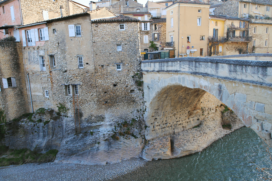
- The 12th century bridge (known as the “Devil’s Bridge”). The bridge has been classified as a historic monument since August 23, 1916;
- The whole of the old village made up of cobbled streets and alleys and caladas (sloping streets paved with Jaur pebbles);

- Saint-Laurent church in Olargues, built in the 17th century and equipped with a listed organ. The old bell tower was registered as a historic monument in 1928;
- Saint-Laurent decanal church in Olargues;

- The Saint-Roch chapel in Olargues;
- The Saint-Étienne d’Olargues chapel;

- The Notre-Dame-de-Montligeon chapel in Rieumègé;
- The Saint-Martin-des-oeufs chapel in Olargues.

How to get to?
From Paris: 7 hr 50 min (755 km) via A71 and A75
From Toulouse: 2 hr 23 min (143 km) via D612

From Andorra: 4 hr 15 min (273 km) via N20
From Monaco: 4 hr 59 min (463 km) via A8

From Madrid: 9 hr 43 min (943 km) via A-2
From Moscow: 37 hr (3,389 km) via E30/M1
From Belgrade: 18 hr 24 min (1,767 km) via E70
From Istanbul: 29 hr (2,716 km) via E70
From Bern: 7 hr 14 min (721 km) via A1
Main information
Area: 18,6 km2
Population: 550

Coordinates: 43°33′26″N 2°54′55″E
Language: French
Currency: Euro

Visa: Schengen
Time: Central European UTC +1

See here Pyrenees travel guide
See here France travel guide
See here Spain travel guide