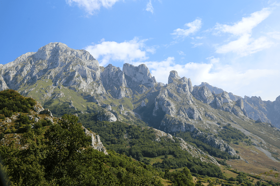
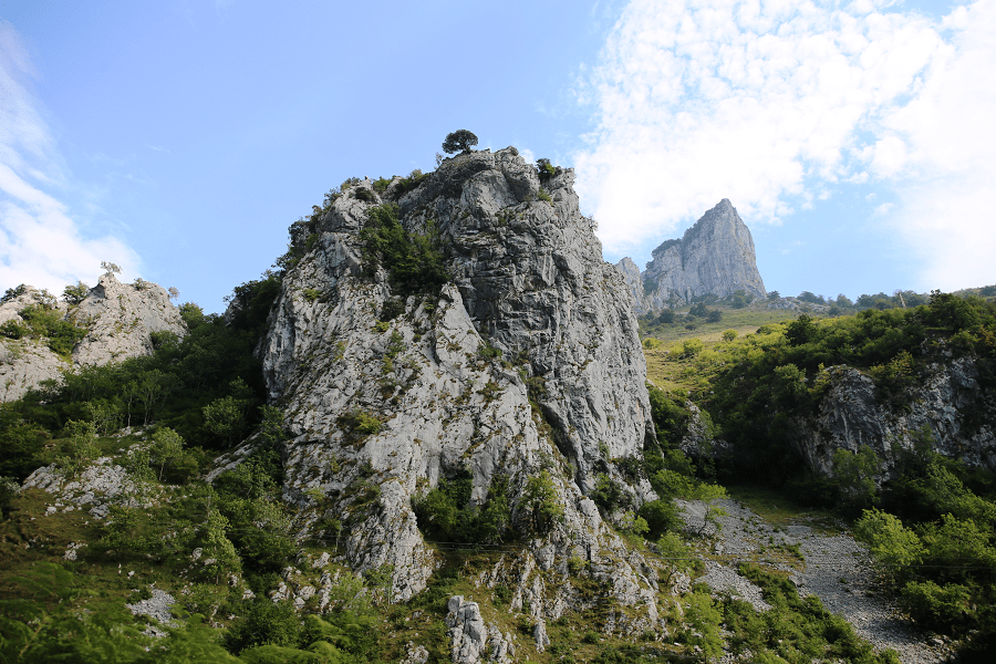
The Picos de Europa are a mountainous massif located in the north of Spain that belongs to the central part of the Cantabrian mountain range. Although not very extensive, its proximity to the sea makes it abundant in geographical features of great interest. Currently, the Picos de Europa National Park is the second most visited national park in Spain, after the Teide National Park (Tenerife).
This limestone formation extends through Cantabria (mostly), Castile and León and the Principality of Asturias, and its heights stand out, in many cases above 2,500 m.
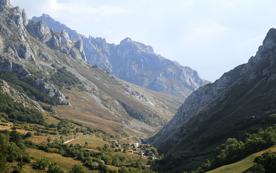
Geographically, the Picos de Europa are in the line of the Cantabrian mountain range, although they are considered as an independent unit of it due to their most recent formation. They occupy a total area of 67,455 hectares distributed among the three provinces.
The Picos de Europa are divided into three massifs: the Western or Cornión massif, the Central or Urrieles massif, and the Eastern or Ándara massif.
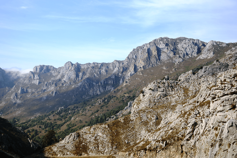
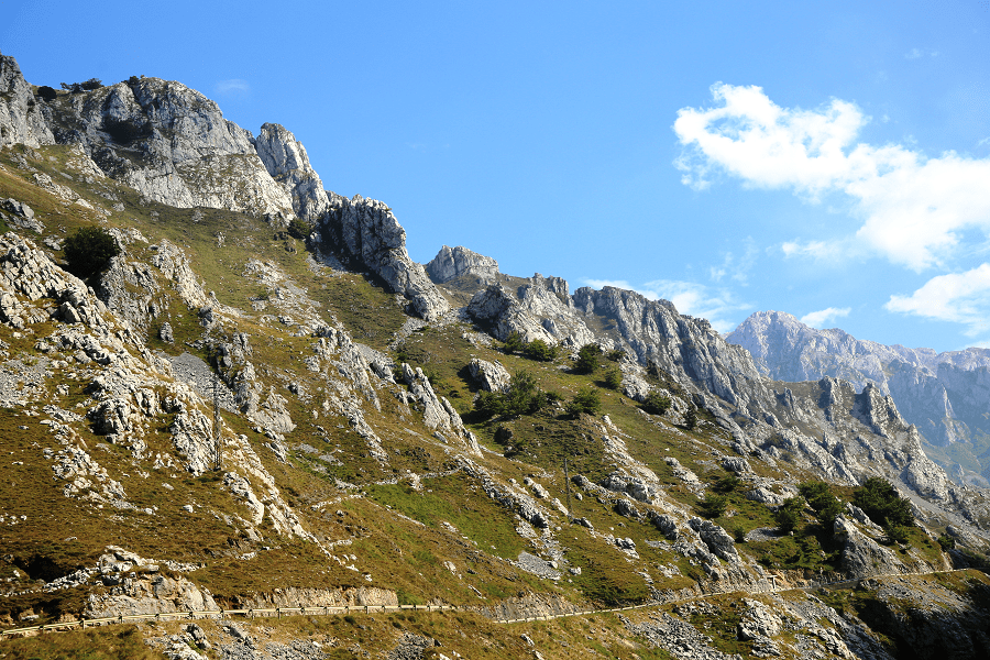
The greatest heights are found in the Urrieles massif, which happens to be the wildest of the three, since fourteen of its peaks exceed 2,600 m in altitude, with the Torre Cerredo, 2,650 m, as the roof of these mountains and third maximum of the entire Iberian Peninsula, after Sierra Nevada and the Pyrenees.

Another mountain that is part of this massif is Picu Urriellu or Naranjo de Bulnes, of great historical importance in Spanish mountaineering. It was conquered for the first time on August 5, 1904, by Pedro Pidal, Marquis of Villaviciosa, and his companion and guide Gregorio Pérez Demaría, a natural shepherd from Caín de Valdeón, ascent that is considered the birth of mountaineering in Spain.
In the Western massif or Cornión, named for the shape of a horn that offers its silhouette when seen from the west, the Peña Santa stands out, which with its 2596 m of altitude exceeds the next peak of this massif by 110 m, the Torre of Santa María or Torre Santa de Enol. Because of these two mountains, the Peña Santa and the Torre Santa, this massif is also known as the Peñas Santas.
The Eastern massif, also called Ándara because the circus of the same name is in it, is the most modest of the three, both in height (its roof, the Morra de Lechugales, reaches 2,444 m) and in verticality.
A widely accepted origin for the name is that they were the first sight of Europe for ships arriving from the Americas.The name can be traced to Lucio Marineo Sículo, who mentioned the Rupes Europae in 1530.
The Picos de Europa contain many of world’s deepest caves, including Torca del Cerro (−1589 m), Sima de la Cornisa (−1507 m), Torca los Rebecos (−1255 m) and Pozo del Madejuno (−1252 m). Discovery of new caves and their exploration still continues.
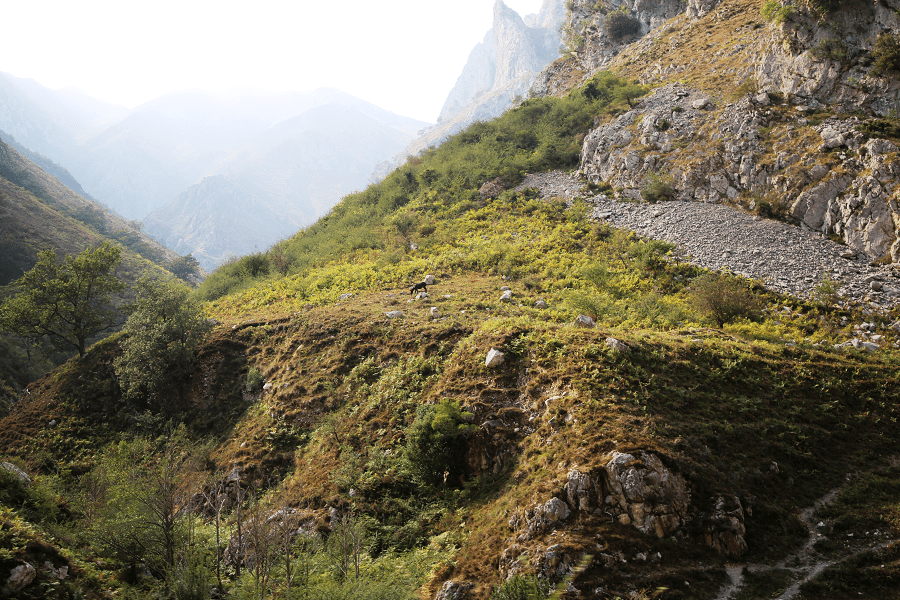
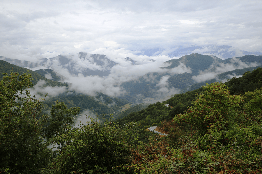
Picos de Europa has the best hiking routes in the whole of Spain. This includes day-hikes such as the Cares Route, which runs along the Divine Gorge and is around 12 kilometres long. Among others, the route from the Fuente Dé cable car, which passes the peaks of Tesorero, Horcados Rojos and Peña Vieja, as well as the Ordiales Scenic Balcony Trail, offering some of the most beautiful vistas and measuring 11.2 kilometres in just one direction.

The most popular routes:
Pueblos de Sajambre: the 12 km route to discover the main villages and towns.
The Archdeacon’s Trail: The 28 km trail is divided into two. The first path passes Puerto del Pontón to Soto de Sajambre (easy), the second passes Amieva (complexed).

Desfiladero de Los Beyos: The path follows the Sella River (12 km). The entire round-trip is about 32 km.
La Vega de Llos: The 13 km circular footpath passes the Valley of Valdeón and offers some stunning views of the park.
Main attractions
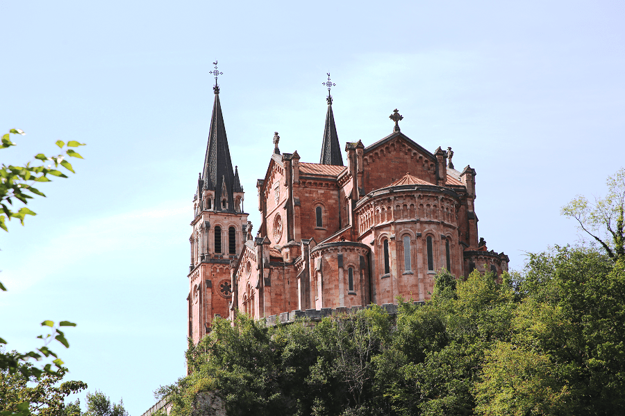
The Sanctuary of Covadonga – cradle of Spain
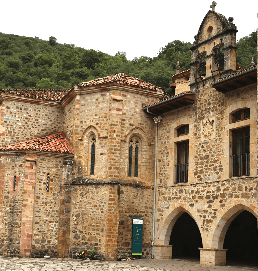
The Santo Toribio de Liébana monastery – a National Monument
Ribadesella and the International Descent of the Sella
How to get to?
Nearest international airports are in Oviedo and in Santander.
From Oviedo (Asturias) 2 hr 55 min (148 km) via A-8
From Santander (Cantabria) 2 hr 41 min (127 km) via A-8
From Valladolid (Castile and León) 4 hr 35 min (325 km) via A-67
From Madrid 6 hr 33 min (535 km) via A-67
GPS coordinates: 43°11′59″N 4°48′02″W