The monumental complex of Olèrdola, also known as Olèrdola Ruins or Olèrdola Village (cat. Conjunt monumental d’Olèrdola, conegut també com a Ruïnes d’Olèrdola o Poblat d’Olèrdola), is a strategic archaeological site occupied from the Bronze Age to the medieval period, with long periods of abandonment. It is currently one of the sites of the Archeology Museum of Catalonia.
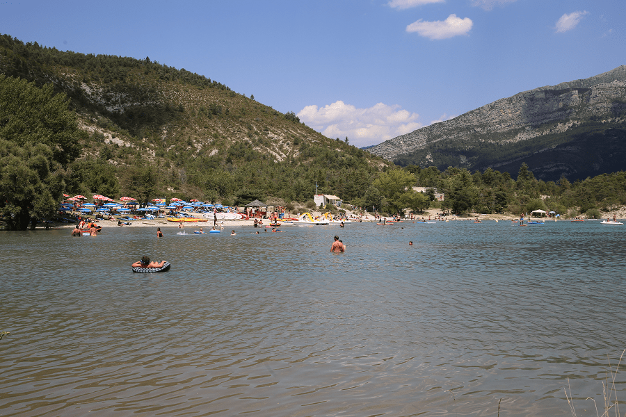
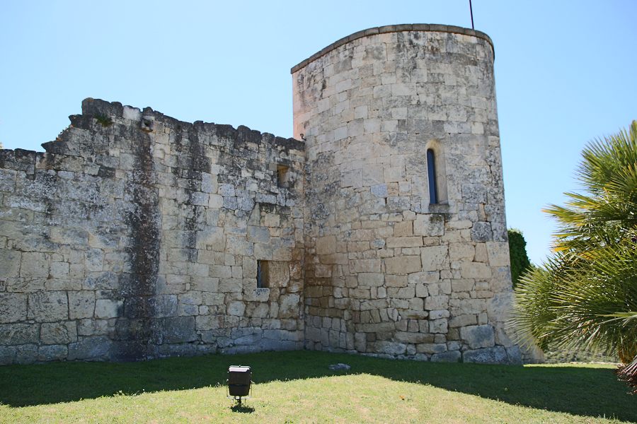
The monumental complex of Olèrdola is located on a 358-meter-high rocky platform on the western slopes of the Garraf massif (Catalonia, Spain), within the Olèrdola park, dominating the Penedès plain. Inside the fortified medieval enclosure, the space was divided into three areas. On the upper part was the military zone, with the castle at the top and, further down, the sacred area, with the church and the necropolis. The lower part of the mountain was occupied by houses. The archaeological excavations carried out at the Olèrdola Monumental Complex have allowed to establish the chronology of settlement of this site from the Ancient Bronze to the medieval period, with long periods of abandonment. It is known that the old city of Olèrdola was inhabited in the Neolithic era and the bronze age and, later, by the Iberians. Its strategic position made it a favorable fortification place during warlike periods but not very attractive during periods of peace.
Iberians
Although inside the fortified center materials and structures of the Ancient Bronze Age have been recovered (a beaker vase from Solomon complex and a bucket with handmade ceramic materials from Early Bronze to Middle Bronze Age, remains of fauna and flint), a stable and organized urban development that it presents is from the Late Bronze.
The first well-known fortification is from this time (9th-8th century BC). This defensive wall is parallel to the well-known Roman-Republican wall and conserves an internal transverse wall, of which the upper part was used in the Iberian era. During the 4th century and until the end of the 2nd century BC, it was occupied by an Iberian settlement. In this Iberian phase, the wall from Late Bronze was reused and houses and a street were adapted, structured against the defensive part of the wall which would be included in the later tower of the Roman-Republic era.
Roman times
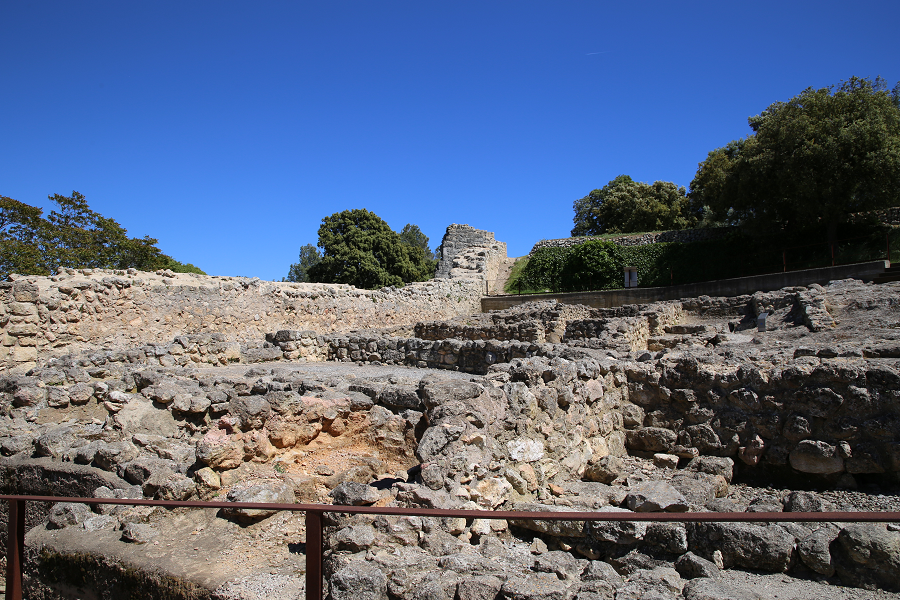
At the end of the 2nd century BC, the Romans raised another wall in front of the previous one, a watchtower and probably a large cistern, carved into the rock with a capacity of more than 350 m2. The cistern dimensions were 16.4 m long x 6.5 m wide x 3.5-4 m deep. This cistern is considered to be of Iberian or Roman-Republic times and was reused in medieval times. Two quarries were also located from this time (late 2nd century – beginning of the first century BC), one inside the walled enclosure and the other in front of the curtain wall. Towards the middle of the 1st century BC, Olèrdola was abandoned but a medieval occupation took place as of the 9th century. It seems that a field of granaries carved in the sedimentary rock belong to the first moments of the medieval occupation.
Medieval era
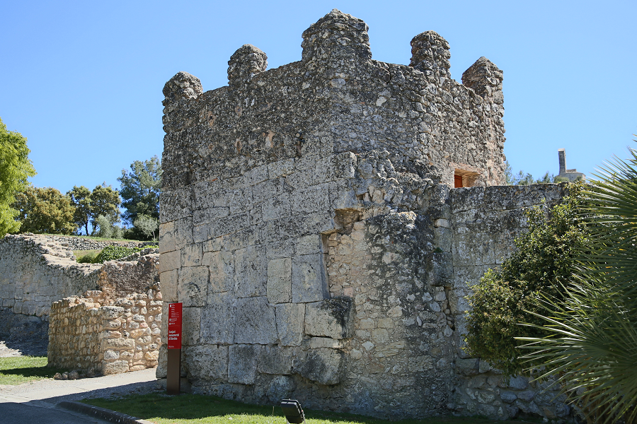
In the Middle Ages, the fortified site was once again inhabited. According to the documentation, Olèrdola was “founded” in 929 by Sunyer I of Barcelona (912-954), who built a perimeter wall, the churches of Sant Miquel (inside enclosure) and Santa Maria (outside) and the castle. Throughout the 10th century, in the territorial struggles between Christians and Muslims, the castrum of Olèrdola had an important role in the control and defense of the southern part of the County of Barcelona. It suffered many Muslim raids like the one of the year 985 of Almansor, who sieged the plain of Barcelona, the capital itself and won in the battle of Rovirans.
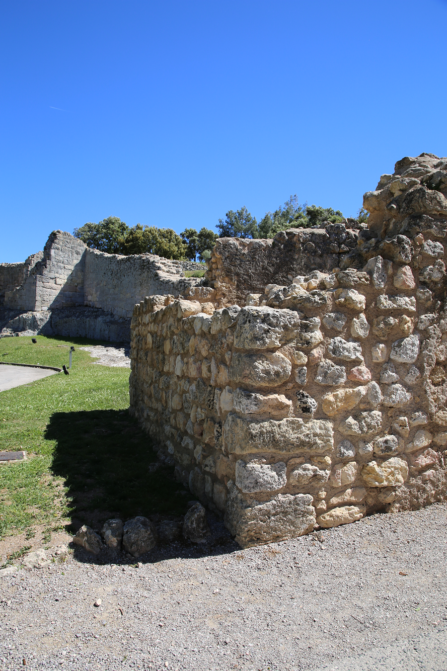
The urban structure of the Late Middle Ages village shows two centers, inside the fortified enclosure, on the upper part was the military zone, with the castle and further down the sacred area, with the church and the necropolis. Occupying the middle part of the rocky platform there was an area of economic activity: press and wine cellar, the Roman cistern in use again, the reopened Roman quarry, a granary and others. The lower part of the mountain was occupied by the houses of well-off peasants and by artisan workshops, including a blacksmith, which opened on the main street around the entrance gate. The residential areas stretched outside the walls, the best known one is the Pla dels Albats, with the church of Santa Maria and its necropolis of anthropomorphic tombs or “olerdolanes”.
At the beginning of the 12th century, the decline of Olèrdola began with the displacement of the population towards the plain. The great invasion of Almoravid in 1108, just after the Muslim incursions in Catalan territory, caused the devastation of Olèrdola. The counts, once the invaders had withdrawn, tried to stimulate the repopulation by granting large franchisers, requesting the collaboration of the monastery of Sant Cugat and entrusting the custody of castle and the city to Jordà de Sant Martí, whose descendants owned the castlania until the 13th century. All the ceramic material recovered is gray ceramic vessels, no glass, which suggest abandonment of the site by the 13th century. On the western cliff, part of the medieval wall that surrounded the platform was located, which was about 60 cm wide.
Modern era
The fortress lost all its strategic importance. Sporadically, it had temporary garrisons during the time of armed conflicts, as in the Catalan Civil War in the 15th century or during the Peninsular War in the 19th century. Then it was totally abandoned even though in the 17th century it was still a place owned by lord Rey. The church of Sant Miquel was parochial until 1884, when the Bishopric of Barcelona sold it with the whole enclosure and the place became an agricultural farm.

Present times
There are modern structures (19th century) corresponding to cultivation on terraces, reconstructions and an oven which was probably destined for a metal foundry.
In 1963, the Deputation of Barcelona acquired the farm. In November 1971, after some reforms to the church and the construction of a new building on the site previously occupied by an old farmhouse, the monumental complex of Olèrdola was opened to the public. Since 1995, the historic center of Olèrdola is one of the sites of the Archeology Museum of Catalonia.
Olèrdola was declared a Cultural Asset of National Interest, in 1931 and an Asset of Cultural Interest (from cat. Bé d’Interès Cultural BIC).
In 2007, geophysical surveys with georadar and magnetic gradiometry were carried out, which allowed the identification of previously unknown underground structures. A pre-Iberian wall, parallel to the Roman one, separated by 6m, has been detected as well as a possible closure to the East of the structure and structures that divided the internal space between the two walls and upper levels in the resulting rooms. A gate to the West, fire zones and internal divisions have also been discovered. Another detection was the old path of access to the Pla dels Albats, parallel to the outside of the Roman wall. Inside the castle the continuation of the side walls have been identified and the possible presence of two levels have been pointed out.
Coordinates: 41° 19′ 18″ N, 1° 43′ 23″ E