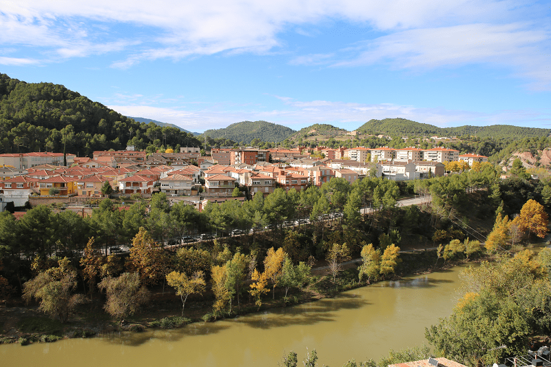
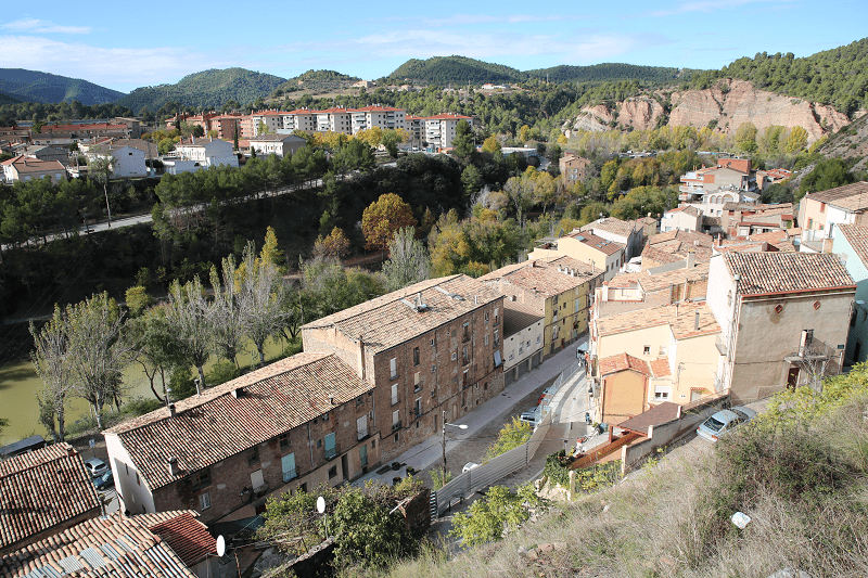
Súria is a city and municipality in Spain, head of the municipality of the same name, in the Bages region, Catalonia. It is located about 15 km from Manresa, the capital of the region, in the Cardener valley, which crosses the town leaving the popular district of Salipota to one side, and the other the oldest part of the town under the promontory where the Old Town is located, built around the castle in a narrow and walled area, retains all its medieval appearance with narrow streets, arcades and porches.

Broken up by the foothills of the Castelltallat mountains (601 m), to the west, and Castelladral (515 m), to the north. The terrain is also drained by the torrent of Coaner, the Cardener tributary on the right, and the Tordell and Hortons streams tributaries on the left. The highest peak is the Puig de Sanç (613 meters), to the east of the municipal district. The potassium mines of Súria, located 600 meters below the surface, are the lowest artificial point in Catalonia. The area of the municipality is 23.54 square kilometers. Its altitude is 281 meters above sea level. Súria is bordered by the territories of Navàs, Castellnou of Bages, Callús and Sant Mateu of Bages.
The improvement of the road of the Cardener axis in the last decades has made Súria a well connected municipality, 13 kilometers from the transverse axis by the link of Sant Joan de Vilatorrada and 15 kilometers from the axis of the Llobregat by Balsareny. Súria is 9 kilometers from Castelladral (Navàs), from where you can see a broad perspective of Central Catalonia.

Súria has a typical Mediterranean mountain climate, with an average maximum temperature of 32.5 degrees during the summer and a minimum average temperature of 1.3 degrees during the winter. The average annual rainfall is 550 liters per square meter, equivalent to 65 days of rain per year.
Súria is a point of great geological interest for the confluence of the Balsareny and Súria anticlines, separated by the fault of the Tordell. One of the places where the anticline of Balsareny emerges on the surface, the so-called Migmón, is one of the main symbols of Súria and is part of the shield of the town.
65 million years ago, the collision between the Iberian and Eurasian tectonic plates led to the creation of an inner sea that was trapped between the mountains of the Pyrenees, then in formation. The deepest zones were in central Catalonia and in Navarre, and received large amounts of fluvial sediments that became the origin of salt deposits as the waters of this inner sea evaporated until their total disappearance.
El Migmón is a geological structure that is the characteristic of Súria. It is a balsareny anticlinal fold, in which two layers of rock converge that do not link between them due to the intensity of the fold.
The name comes from a local tradition, according to which in this place the two halves of the world separated, given the peculiar form of the folding. The Migmón is part of the shield of Súria and has given name to the secondary school, organizations and to different commercial establishments of the city.
The Migmón is at the exit of the town in the direction of Cardona, on the right side of the road. A good place to see it is located in the neighborhood of Salipota, in the direction of the road, at the intermediate point between the cemetery and the mining facilities of the Cabanasses shaft.
History
The first inhabitants of Súria were the Iberians, who had colonized the peninsula in 3000 BC. In particular, those who were located in the Bages area were called Lacetans. They were invaded in 218 BC by the Carthaginians, who stayed there until they were defeated by the Romans in 195 BC. The Roman period in Súria lasted until 409 AD and during that time Súria was called Sorisa. The Roman Empire ended with the invasion of the barbarians who passed through Catalonia, but they did not stay permanently. After several battles those who stayed in Súria were the Visigoths until 476. Then they were pushed northwards by the new invaders, the Muslims.
In 720 Muslims invaded the Bages but in 732, as a result of the defeat of Poitiers (France), they withdrew and the Bages district was depopulated, hence Súria was no man’s land until 993, a year when it appears that there was a castle. In 1035 the terrain of Súria was part of the county of Barcelona, and since its counts were of Christian religion, it can be said that Christianity had already arrived to Súria in the XI century. The origin of the urban core of Súria must be sought at the end of the medieval era, although it was not until later (XVII and XVIII centuries) that it experienced its greatest growth and Súria became a fortified town, taking advantage of its natural location.
The year 1932 saw one of the main points of the uprising of the Alt Llobregat and the town remained isolated for four days, after the proclamation of libertarian communism.

In the context of the Spanish democratic transition, in July 1977, during a protest against the gala dance of the Festa Major, the firing of the weapon of one of the civil guards ended the life of Roque Peralta, resident of Manresa and father to three children. These facts, that shocked the inhabitants of this town of Bages, were never brought to justice.
Places of interest, travel guide and what to see?
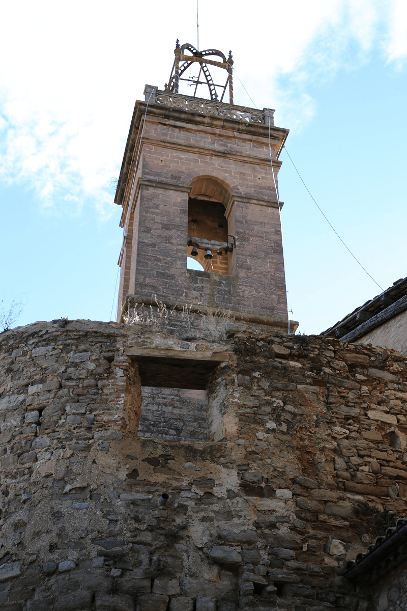
The Church of Our Lady of the Rosary of Súria (L’Església de Nostra Senyora del Roser de Súria) was the old part of the castle and the parish probably were. It appears cited in relation to the parish prior to 1154 as a parish of “Sorisa”. Of the Romanesque work erected in the XII century, only a small part of the nave, the apse and the bell tower are preserved, although modified by extensions. The apse is semicircular and was extended out in order to fortify it. The two constructive stages are very evident by the system and the quality of the building. In the center, a window opens, with a wide opening that houses a grille. Originally it must have been double-seized. In the southern part of the apse there is another Romanesque window, now walled, by two blocks of stone, in the form of columns, crowned by a monolithic block in the form of a semicircular arch. This arch has been decorated with geometric motifs and highlighted by archivolts. The bell tower consists of a basement and three floors, lacking ornamentation and only indicated by the windows.
Campanar. Square-shaped tower that retains an old part with floor-to-ceiling windows on each face and adorned with columns that split them. The upper part is modern and was finished in the late 19th century. The old bell tower is considered the best Romanesque bell tower of the region.
The difference in materials between the two parts is quite remarkable. In the Romanesque part the ashlars are thicker and are more damaged by erosion and time. The stone on the upper part also presents two differences, the upper one is thinner, lighter, in order to reduce weight.
The lower part of the bell tower is from the 11th century. The first floor is perforated by four windows (each facing a wind), simple and with upper half arches. On the second floor, the windows are geminated and have semicircular arches supported by a column that has a mensuliform capitulum. On the top floor there are windows identical to the ones in the previous floor with only one difference, they are of larger proportions. At the top of this floor there is a cornice that limits the Romanesque work and modern work.
Currently, it is still used for worshiped and is in a good state of preservation.
The church of El Roser is documented in relation to parishes prior to 1154. The first moments it was the parish church of Súria, a function now preserved by the Church of Sant Cristòfol de Súria. It was dedicated to St. Cristòfol, current patron saint of the town. The expansion that the town of Súria went through from the 17th century led to the creation of a new church. From the old one, the original apse was used as a sacristy and bell tower, enhancing it. The church was profaned in 1936 and in 1939 it stopped performing parish duties.
In 1954, the old parochial temple was reopened under the protection of Nuestra Señora del Roser.
Like the other churches in the municipality, it belonged to the bishopric of Vic until in 1957 when they were incorporated into the one of Solsona.
The extension of the bell tower was made in the 19th century when the castle no longer had any military interest, and the height of the bell tower did not interfere visibility.
The present church was built in 1868 on an 11th-century Romanesque church. The bell tower and the Romanesque apse are still preserved. From the 11th century the Main Altar is also preserved, where the figure of San Cristóbal, patron saint of Súria, was portrayed, but in 1936, due to the Spanish Civil War, the Main Altar was burned.
A first it was the parish church of Súria, a function now preserved by the Church of Sant Cristòfol de Súria. It was dedicated to St. Cristòfol, current patron saint of the town.
The building, which originally was Romanesque, kept losing its medieval structure until only a few significant elements remained. Currently, of which from the 11th century remains only the apse and bell tower although they have also been modified.
Santa Maria de Cererols. Santa Maria de Cererols is a church of the municipality of Súria (Bages) protected as a cultural asset of local interest. Precisely, it is located on Cererols farmhouse, located on top of a hill, called Collet, in the south-east of the municipality of Súria. The site of Solariolos was first documented in 993 and was within the territory of the castle of Súria.
Cererols has a main nucleus formed by the church originally dedicated to Saint Martin and then to Santa Maria de la Concepció, documented already in 1063, it is a small pre-Romanesque building with a single nave and with a single apse in the eastern corner. Between the 16th and 17th centuries, it underwent a series of renovation and enlargement works, among which the nave was extended, a porch was added to the east corner and a new bell tower was built. The manresas sculptors Josep Generes Pau and Josep Sunyer were authors of the baroque altarpiece, destroyed in 1936.
The cemetery was on the north side of the church, where the Romanesque door was, and when the porch was added it was moved to the south side. The last buried people were two brothers of the Lladó family, killed during the Civil War from 1936 to 1939. It should be noted that in the interior of the church there are remains of polychrome, some of which have been Romanesque. Nowadays, after the restoration of 1991, we can see a reconstruction of these old paintings.
It is a hermitage chapel of medieval construction (principles), with modifications and elements added at later times. The church is preceded by a high atria created to cover the graves that are on the ground. Ones entered single nave can be found of 12 meters (without the presbytery that is higher) by 4.37 m. There is a triumphal arch that separates the presbytery from the nave. The apse has a very pronounced horseshoe floorplan (218º in circumference), and the ceiling in the shape of a semi dome is considerably lower than that of the reduction arc, causing it to remain as a kind of curvilinear fronton. It has three small windows and very damaged Romanesque paintings. The exterior is restored. The material used is ashlar.
The Romanesque portal is from the 11th century. Located in what would be a side of the church, it features a half-point arc made with regular voussoirs. Covered since the 17th century, when the church was extended. The stone baptismal font has a height of 1.5m. It has a square foot, without decoration and with the corners crushed. The sink is ornamentally worked both on the outside and inside with a motif of petals as if it were a flower. Inside there is a circle with an inscription: the acronyms of Christ and the year 1598. The stone presents the prints of the chisel in a work of uniform and polished result.
The 17th century was the most active in regards to works in the church. During this period, the old entry (presently covered and located on one side) is extended by adding to it the atrium. Approximately in 1593, the church changed its cult: it was first created in honor of Saint Martin and from that year paid tribute to the Virgin.
Important dates, festivals and holidays
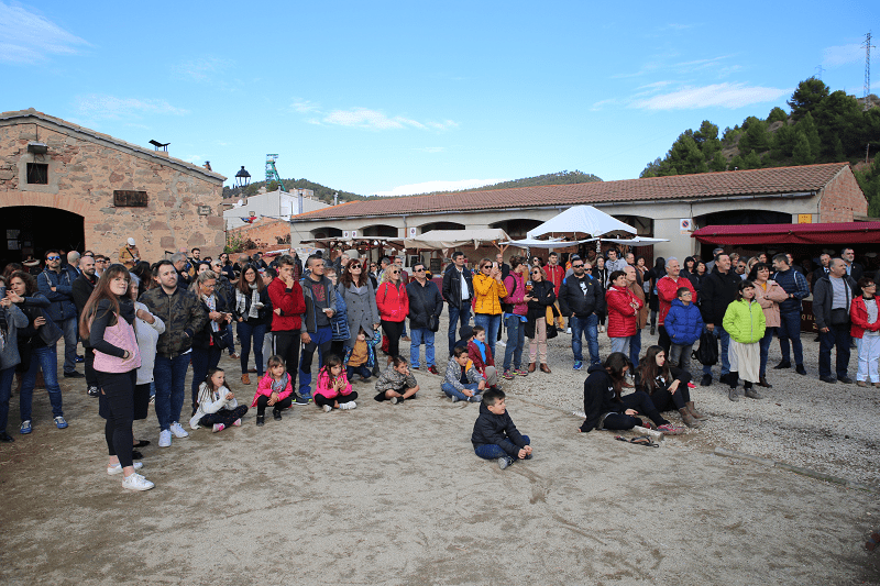
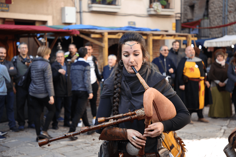
Medieval Fair
The Medieval Fair of Súria, during the first days of November, makes a return to the old traditional trades. Súria opens its doors to anyone who wants to enjoy a weekend doing activities of the Medieval Age. The narrow streets, great bonfires, traditional stalls, porches, good smell of herbs and the animals are some of the spaces and elements that we can enjoy walking through the Old Town.

There are stalls with trades such as: stone cutting, stonemasonry, basketmaking, farriers, woodcarving, spinning, weaving, blacksmiths, fortune tellers, bakers, leathercraft, ceramics, herbalists, cartoonists, cooks, alchemists, toymakers, bufons, cordwainer, laundry, bookbinding, tailors, spoon makers, etc.
There are also workshops for adults to participate and where children can have a good time, such as:
● Leather workshop, in which you can make necklaces and bracelets with this material.
● Binding workshop, you learn to bind books with leather covers, as they did in the Middle Ages.
● Toy workshop, in which toy characters are designed, built and dressed: medieval kings and queens, princes and princesses, …
● Stilt walking workshop, you learn to walk on stilts so that you can see everything from a different perspective.
● Medieval games workshop, games of the Middle Ages are discovered: the Board of the King, the Foxes and Geese, the Hnefa-Tafl

Festa Major
It takes place in July, from around 7th to 13th. Every day is filled with diverse activities, from inflatable castles for children, fishing contest for young people, castellers, giants, dances, parties, theater, etc.
One of the most typical events of the Festa Major of Súria are the fireworks, which take place on the last day of the Festa Major and which are shot close to the river Cardener.
Caramelles
Súria is one of the most important towns in the field of Caramelles for about 400 years. This is thanks to all the people who participate, since more than 500 people are grouped together in several bands. Also thanks to the trabucaires, the tours, all the musical accompaniment and the fact that the groups are made up of people of all ages. It is a tradition that goes from parent to child. It takes place during Holy Week.
The first document related to Caramelles de Súria dates from 1,594: a papal bull of Pope Gregory XIII in which the existence of the brotherhood of Roser is spoken.
The caramellaires are grouped into bands that were formerly formed for reasons of age or neighborhood. Later in the twentieth century, local entities and cultural associations became very important, and today, they are the basis of Caramelles.
The songs are the basis of the performance of the groups that usually carry musical accompaniment. Historically, caramelles songs had a religious content, but over time, and continuing to this day, other themes including humor and satire, were introduced.
The interpretation of the songs is choral often accompanied by some instruments, the most common are: trumpet, clarinet, violin, accordion, bass, guitar, gralles, flabiol, timbal or drum.
Some groups complete the musical performance by incorporating Catalan dance performances with own choreography or inspired by dances from other territories of the Catalan Countries. In this sense, characteristic traits of the Caramelles of Súria are the dances of cascavells and the dances of bastons. Both of them give spectacularity to the Caramelles and, both sticks(bastons) and jingle bells (casavells) have become the characteristic sound of the party.
The trabucaires also stand out from the 17th century. The noise of the blunderbusses (Trabucks) accompanies the passage of bands through the streets and squares of the town throughout the morning of Easter Sunday.
Characteristic of the Caramelles are also crossbows and locks. The arbalists (els ballesters) are caramellaries that through the crossbows (extensible wood weapon that allows to overcome distances and heights in a moment) send flowers to the people who watch the party from the balconies and windows of houses. The lloques are the caramellaires in charge of collecting the voluntary donations received as a gratitude for the performance of the groups and that then deposit it in a basket decorated with tapes or bells. In return, the donor receives a sheet with the lyrics of the songs performed.
Formerly the bands carried their performances of singing and dance in to the country houses. Tradition that is still performed today on Easter Saturday.
During Easter 2015 the participating groups were: The Coral Sòrissons, formed by about 35 singers; The Children’s Group of Cultural Promotion (La colla Infantil del Foment Cultural), made up of about 90 children but reaching up to 140 with the accompanists; The Juvenil group of the Cultural Promotion (La colla Juvenil del Foment Cultural) with a hundred caramellaires; La Societat Coral la Llanterna, one of the most veteran with more than 125 years of history formed by 25 singers; La colla Infantil de l’Agrupació Sardanista consisting of about 120 members among bastoners, dancers and singers;La colla Infantil de l’Agrupació Sardanista with a hundred caramellaires; La colla del Tro-Gros the oldest one, with 140 years of history and about 130 participants between adults and children; and Els Altatxu that groups about 250 caramellaires.
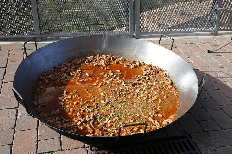
Cuisine, food and restaurants
In the city there are more than 10 restaurants of a fairly high quality. Prices are cheaper than in Barcelona and Lleida. Mostly located within the borders of the Old Town.
Shortest distances
From Girona 1 hr 28 min (132 km) via C-25
From Lleida 1 hr 21 min (123 km) via A-2 and C-25

From Tarragona 1 hr 28 min (125 km) via AP-7

From Barcelona 1 hr 7 min (74.1 km) via C-16
From Madrid 6 hr 1 min (585 km) via A-2
From Andorra 1 hr 57 min (122 km) via C-14
From Paris 9 hr 57 min (939 km) via A20
Main information
Area: total 23.6 sq. km
Population: total 5,999
Coordinates: 41°50′10″N 1°45′10″E
Languages: Spanish, Catalan
Currency: Euro
Visa: Schengen
Time: Central European UTC +1, in summer +2