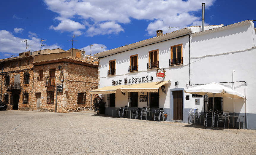
Alarcón is a municipality in the province of Cuenca, in the autonomous community of Castilla-La Mancha, Spain. The city stands on the Alarcón Dam, a gravity dam on the upper course of the Júcar River.
Main attractions
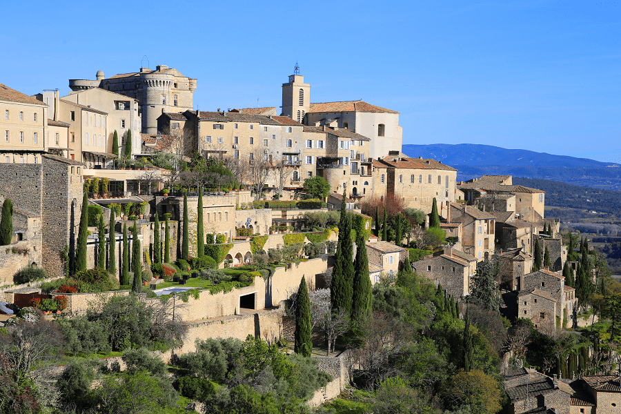
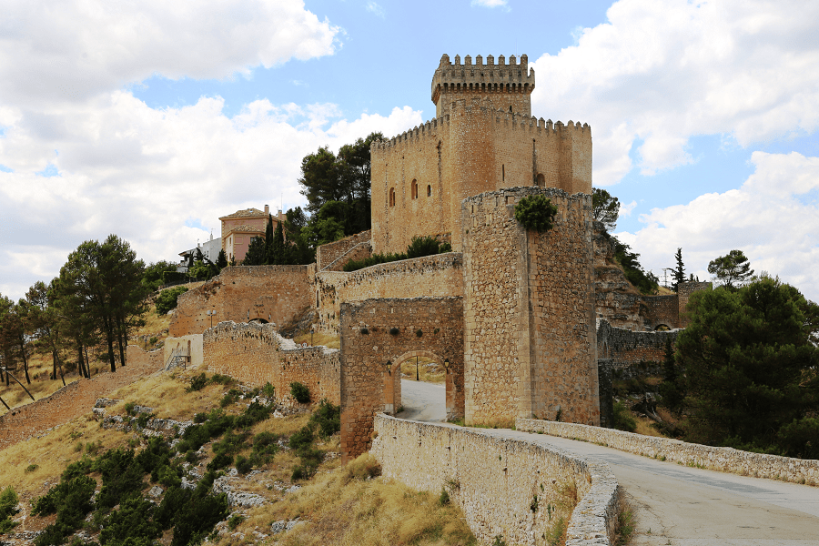
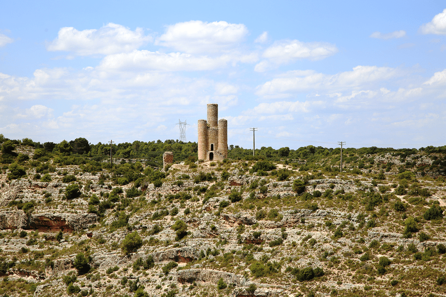
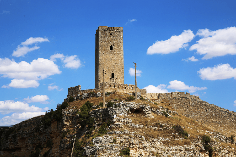
The Castle of Alarcón forms part of the fortifications built around the town. The fortress is composed of a walled enclosure, which houses the heart of the population and the castle proper, and of five exterior towers, separate and strategically placed.

Of Arab origin, the fortress was first under the jurisdiction of the Emirate of Córdoba. Following the collapse of the emirate’s successor state, the Caliphate of Córdoba, and the formation of the taifa kingdoms, the town submitted to the Taifa of Toledo. During its time under Muslim power, the castle served as a defensive stronghold in the midst of internal conflicts.
In 1184, Fernán Martínez de Ceballos, military captain under Alfonso VIII of Castile, besieged the fortress for nine months before finally capturing it in the name of his king. He was rewarded with the privilege of taking the name of the town as his surname, which he did, calling himself Martínez de Alarcón and thus establishing a new lineage.
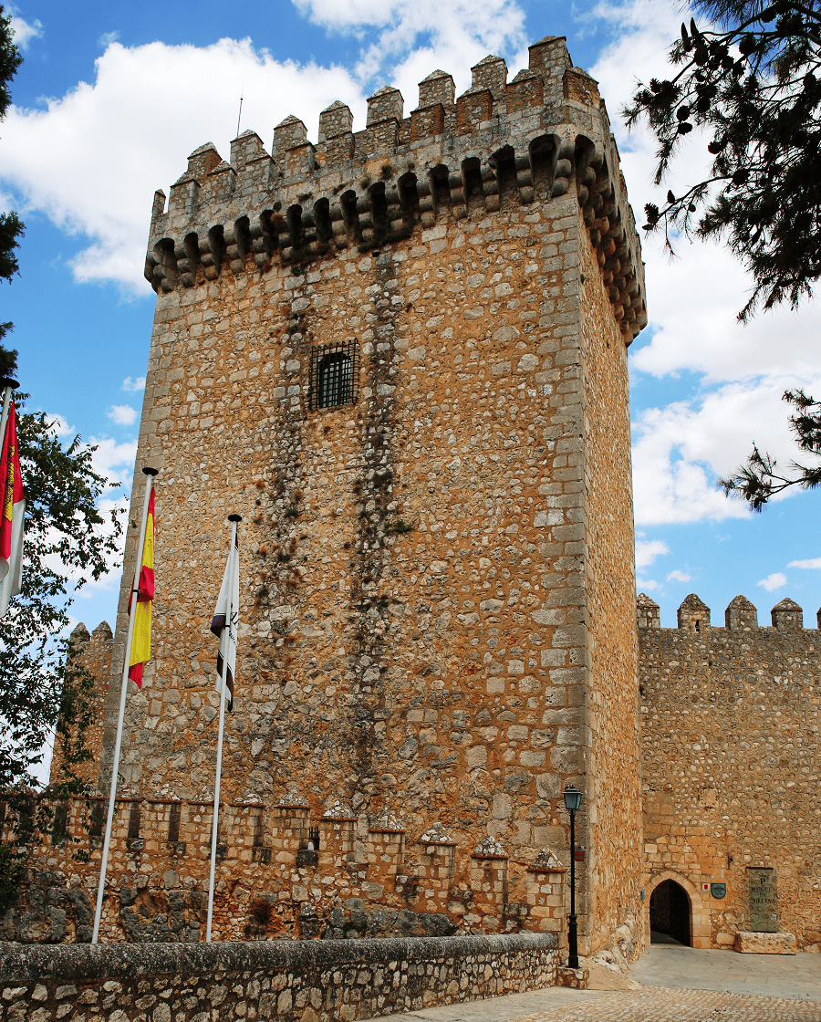
In 1963, the Minister for Information and Tourism, Manuel Fraga Iribarne, expropriated it from the family of Álvarez Torrijos Torres, native of La Almarcha but with paternal ancestors from Gascas. The castle was then revitalized as a parador hotel and opened to the public on March 25, 1966.
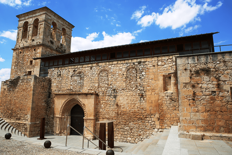
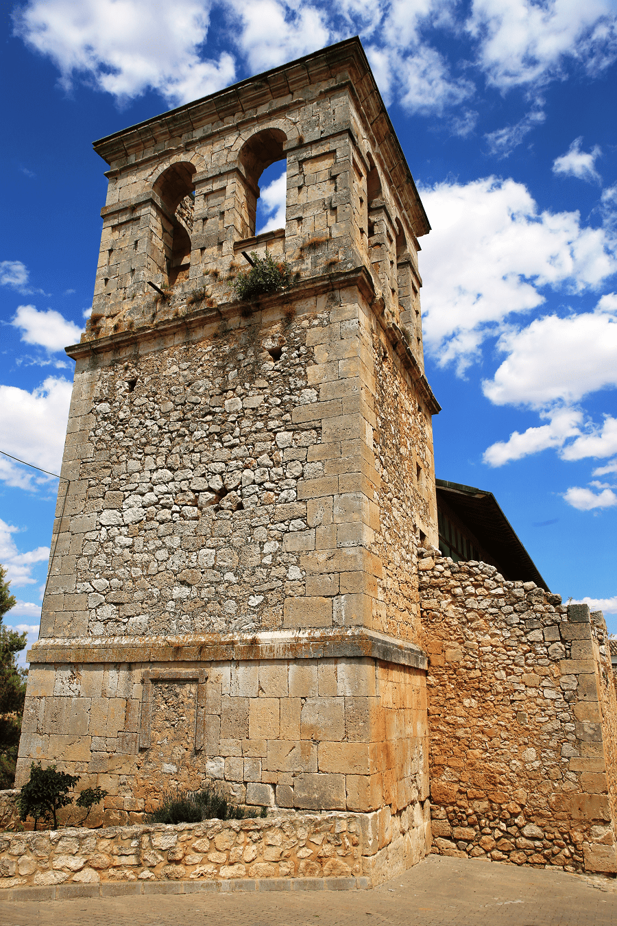
Church of Santo Domingo de Silos, 13th century, was built in the late Romanesque style. Of the original structure, both the semicircular apse in the nave and the southern portal have been preserved. The portal’s splayed arch consists of three colonnettes per doorjamb, capped by pointed proto-Gothic archivolts.

In the 16th century, the square tower and the walls of the nave were built following Renaissance designs, while the Baroque period saw the modification of the ceiling with a ribbed barrel vault. Today the church has been adapted for use as an exhibition hall and auditorium. It was declared a national monument on February 19, 1992.
Art Center – The Murals of Alarcón; Old Church of San Juan Bautista dates from the 16th century as a replacement of the previous Romanesque building. It has a single nave covered with a barrel vault, a portal in the Herrerian style, and a tower that remains from the original church.

Buttresses stabilize the lateral walls; however, contrary to custom, they are located in the interior and thus divide the space into smaller areas that serve as tiny chapels. In 1994, the young Spanish painter Jesús Mateo began the project of covering the totality of the old structure in a set of mural paintings.
UNESCO has officially sponsored this work since 1997 for its global artistic interest, as it is considered one of the greatest examples of contemporary art worldwide. It has drawn more than 40,000 visitors annually since its opening to the public, and received support from many scholars and artists.
Church of the Santa Trinidad comprises two naves, dating from the 13th and 16th centuries respectively, although the vault in the older nave was built in the 15th century. Of note are its pointed ribbed side arches, its chancel arch, and its Renaissance altar. The original Romanesque apse, circular in form, has been replaced by the current rectangular one.
The portal is typically Plateresque; it bears the coats of arms of the Marquis of Villena, Diego López Pacheco, and of his contemporary, Bishop Diego Ramírez Villaescusa. The church tower stands on a portal known as the arco de la villa (town gate).
Church of Santa María del Campo presently serves as a parish church. Erected at the beginning of the 16th century, it was constructed in the Plateresque style and features Gothic tracery in the vault. The portal dates from the middle of the same century and was built by Esteban Jamete (born Etienne Jamet) of Orléans, who is also supposed to have made the altarpiece with scenes from the life of the Virgin Mary, as well as the sacristy.
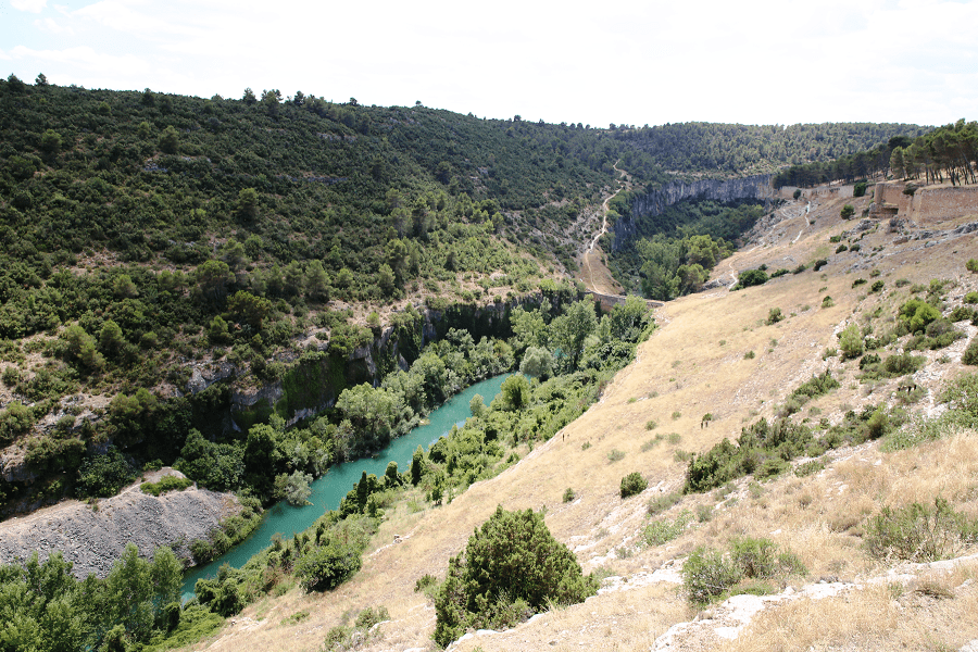
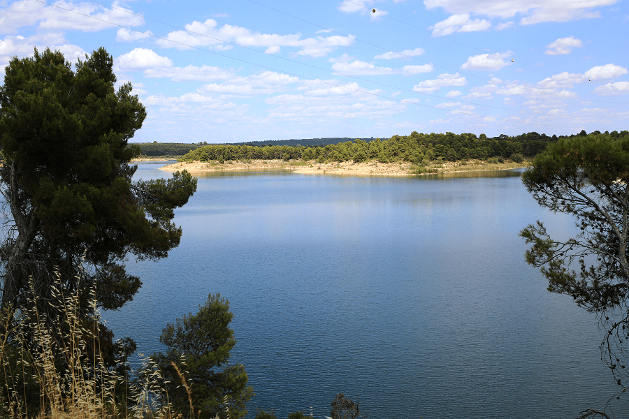
The Alarcón Dam is a gravity dam on the upper course of the Júcar River. It is located 6 kilometres from Alarcón.
The reservoir formed by the dam has a water capacity of 1,112 million cubic metres and spans a surface area of 6,840 hectares. All together, its drainage basin measures 3,033 km2. The dam houses a hydroelectric power plant with an installed power capacity of 56 MW.
The Tagus-Segura Water Transfer, which links two other major rivers, joins the reservoir briefly on its journey south, entering at the northern tail end and mixing its waters with the Júcar.
Construction of the dam began in 1941 through the efforts of Valencian farmers who wanted to stabilize the flow of the river, as irrigation in the province of Valencia depends on that supply of water. This initiative is unique in Spanish history because rather than the State, it was the farmers who assumed the total cost of the project, having organized under the Unidad Sindical de Usuarios del Júcar (USUJ, Júcar Users’ Coalition), an alliance of irrigation communities.
Beneath the waters of the Alarcón Reservoir rest the remains of the town of Gascas, which was flooded after the building of the dam. When the water level drops, one can see traces of the streets and walls, as well as a stone wall with an arch.
The reservoir is located within the municipal districts of the following towns (from east to west): Alarcón, Olmedilla de Alarcón, Tébar, Cañada Juncosa, Buenache de Alarcón, Honrubia, Torrubia del Castillo, Hontecillas, Valverde de Júcar, Castillo de Garcimuñoz, Villaverde y Pasaconsol, La Almarcha, Belmontejo, and Olivares de Júcar.

How to get to?
Distances to the main cities of Castilla–La Mancha:
From Toledo 2 hr 10 min (207 km) via A-3
From Ciudad Real 2 hr 5 min (201 km) via A-43
From Albacete 1 hr 12 min (95.2 km) via A-31
From Cuenca 1 hr 6 min (83.0 km) via CM-220
From Guadalajara 2 hr 16 min (226 km) via A-3
From Madrid 2 hr 3 min (195 km) via A-3
Main information
Area: 119 sq. km (municipality)
Coordinates: 39°33′00″N 2°05′00″W
Population: 156
Languages: Spanish
Currency: Euro
Visa: Schengen
Time: Central European UTC +1