 UAVs have long been a valuable tool for businesses and authorities. Their versatility and high mobility make them an excellent tool for performing an ever-growing variety of tasks, such as inspections of power lines, monitoring public safety, helping rescue missions, delivering goods, looking for minerals, and scanning surfaces, among other things.
MICROAVIA PYRENEES is a leading manufacturer of UAVs and an R&D center for drones. With HQ and production facilities located closely in Dubai, UAE, the team of over 60 employees comprising 18 nationalities delivers some of the best aerial helpers in the market. Microavia is also one of the few companies worldwide providing managed drone infrastructure as a service (MDIaaS).
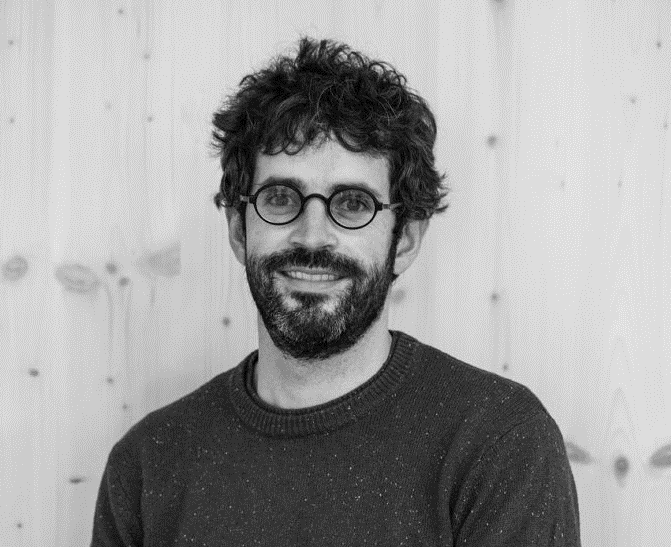
Last year the company expanded its presence in Europe by establishing an office in Andorra to be closer to its regional customers. Andorran office services the Pyrenees area, focusing on work with public sector service providers and mountain resorts. Enrique Plaza Baez, Aeronautics/Aviation Professional and CTO at Microavia, explained how UAVs could support innovation and safety in Andorra.
Interview: Irina Rybalchenko
What exactly are UAVs used for?
The UAV’s deployment spectrum embraces monitoring and surveying, civil protection, measurements and planning, scientific research, video creation, as well as first-response operations. Drones are also widely used for aerial photography and monitoring. Mountain resorts can deploy drones for snow surveillance, filming sports events, and search and rescue of missing people or animals.
The European market for UAVs is quite diverse. What are the main competitive advantages of Microavia?
Microavia has several distinct advantages. First of all, we are one of the very few companies to have a complete manufacturing cycle inside the company. E.g., we create the drones, the payloads, the UAV’s Flight Management System (UTM), and our AI. This means that all components are tightly integrated, which increases reliability and performance.
Moreover, Microavia has a unique value proposition in our Managed Drone Infrastructure as a Service. This model allows customers to rent the drones rather than buy them and perform necessary work on a “pay as you fly model.”
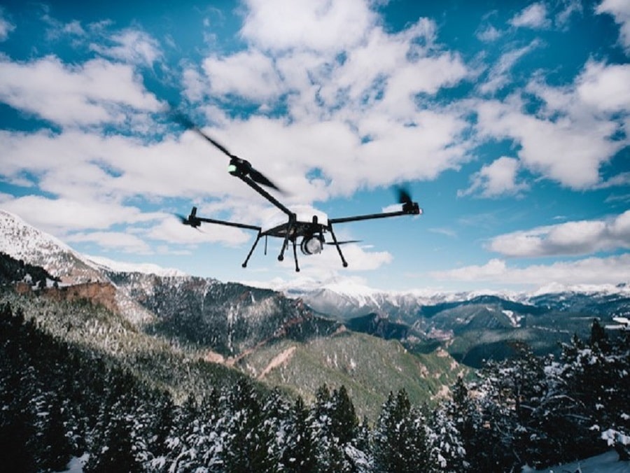
We also have a very robust drone line family, consisting of a drone in-a-box solution intended for autonomous flight, a heavy drone for carrying large payloads and ideal for geophysical exploration, and a tethered drone for 24/7 monitoring.
Most importantly, our drone docks offer great value, as they can be operated remotely. The pilot can sit comfortably in their office in Andorra la Vella and launch missions from a dock located near Lake Juclar. There is no need to drive up there unless there is an actual emergency.
What are the major services delivered by Microavia?
We believe a broad UAV network is the best way to service many needs 24/7. Our job is then to work with the customer to help set up various mission plans, flight schedules, etc. For example, a mountain resort may want a regular perimeter sweep. Once a perimeter around their territory is set, they can run automated monitoring missions to prevent unwanted entities, whether human or wildlife, from venturing into the area.
The operators can react to real-time events, significantly speeding up the security incident response. Strategically placed drone stations can have the drone up in the air in a minute and on-site within a few more.
Two unique parts of our solution enable this: Each dock has three rechargeable batteries swapped automatically and can service multiple drones. Creating a network of docks extends the mission perimeter and allows to set up a carousel of drones taking off and landing 24/7.
Another example of our drone usage is their ability to create detailed snow maps and analyze snow thickness, providing relevant information to groomers and saving time and resources. The same drones can also be used for controlled avalanche detonations.
Given its climate and infrastructure, how can Microavia drones be useful for Andorra, a small mountainous country?
Andorra has many hard-to-reach places. The only way to reach them today is by helicopter. However, helicopters are more suitable for transporting goods, moving, and rescuing people. What if we want to monitor activities only? For example, Andorra has a large number of landslide protectors. If stones fall, they must be removed immediately. A drone is perfect for respective monitoring missions. It is 50-60 times cheaper than a helicopter, and its launch time is only 90 seconds.
We are therefore open to cooperate with helicopter companies, as combining the two options will create a better and more cost-efficient solution for Andorrans.
Wildfires are yet another hot topic. Timely information about the source of a wildfire and its scale will help to distribute rescue resources correctly. A drone can reach the location in a couple of minutes. Upon a quick assessment of the situation, it will help deciding how many firefighters, policemen, or doctors are needed, in a faster and more precise way. The same reasoning principle can also be applied in the case of car accidents.
What are the technical characteristics of Microavia unmanned aerial vehicles: flight range and altitude, cruising speed, engine performance, and operating temperatures?
UAV mathematics is always a balance between flight time and drone weight. Our light drones are built for resilience and are filled with electronics and software developed by Microavia. They have three communication channels (LTE, Wifi, RFD), and the average coverage radius is 15 km (700 sq. km), with a flight time of 50 minutes at 17 m/s (61 km/h).
The drone needs about 1 minute to take off from the station, and its automatic battery swap time is about 90 seconds. Some of its possible payloads include cameras and sensors, such as LiDAR, for creating point clouds with laser scanning.
As far as the heavy-duty geophysical drone is concerned it can carry payloads up to 12 kg. While carrying a 3-4 kg typical payload it can reach 50 minutes flight time, with a cruising speed of 12m/s. The geophysical drone typically carries a magnetometer to scan for minerals or a GPR scanner to look for other underground objects.
Both the station and drones are built to withstand temperatures between -30 and +50C.
Do you already have any experience in Andorra?
Andorra is unique, as our drone dock has been in Andorra since the last winter. It is stationary and effectively demonstrated its resistance to the elements and to low temperatures. Our operators have successfully performed regular tests and test-flights remotely, under different weather conditions. Also, we had the honor of meeting many Andorran representatives and discussing how a drone infrastructure can support various processes.
We have also partnered with Snowplanner, an ARI startup that helps analyze snow cover thickness. The drone, equipped with LiDAR, makes regular flights scanning the snow, keeping track of the snow’s depth and following its evolution throughout the winter season. This data is precise, provided in real-time, and helps save fuel, water, and man-hours.
Also, we have worked together with RTVA at SKIMO World Championship this year. The wind speed reached 70 km/h during the event, but our team of qualified pilots was able to film the start of the contest successfully.
Does Microavia have drone pilot training programs?
Microavia always takes an individual approach to each case. Typically, we train three pilots from each organization with which we sign an agreement. The training can last up to five days, including the exams required to issue a license. The training has two parts: working with our drone management software for mission planning and autonomous drone flight and flying the drone manually with our custom controller.
Merci Enrique! Any parting words?
We are thrilled to be able to call the beautiful Andorra our home today. I hope to share more stories and materials about UAVs helping Andorran innovation in the near future.


