Guérande (Fr. Guérande) is a commune in western France, located in the Loire-Atlantique department in historic Brittany and belonging to the Pays de la Loire region. Its urban part occupies the top of a hill which dominates a territory almost entirely surrounded by water, salt or fresh, called the Guérande peninsula. The history of the town itself is strongly marked by the presence of salt marshes which have made its wealth.
The presence of man on the territory of Guérande is attested from the Middle Neolithic and there are many remains, such as menhirs. The first proven signs of the existence of the present locality date from the second half of the fourth century.
The High Middle Ages was a period troubled by dissensions between the Franks and Bretons—Guérande was then Breton under Merovingian domination—then by the Norman invasions.
The first known written reference of the village of Guérande dates from 854. In the fourteenth century, the city was involved in the war of the Succession of Brittany which opposed Jean de Montfort to Charles de Blois. This ended with the signing in Guérande itself of the treaty of 1365. At the end of the fifteenth century, the city was the refuge for nearly a month of Anne of Brittany and her court.
The Duchess will maintain privileged links with Guérande throughout her reign. Throughout the Middle Ages, the terrouer of Guérande retained a judicial, military, religious and fiscal pre-eminence recognized by the Duchy of Brittany and the Bishopric of Nantes.
The contemporary era is marked by the affirmation of the economic and environmental role of the salt marshes, in recurrent crisis since the Revolution. In addition to the revalorization of the salt production sectors, the tourist interest of the marshes is amplified by the creation of zones of protection of the natural heritage.
In the twenty-first century, the locality remained a dynamic economic centre of the peninsula, increasing its tourist attractiveness by highlighting its rich historical heritage, whether architectural or cultural, and natural; it thus perpetuates the remarkable attraction, manifested since the nineteenth century, of the medieval city and the salt marshes to writers, painters and, more recently, film directors.
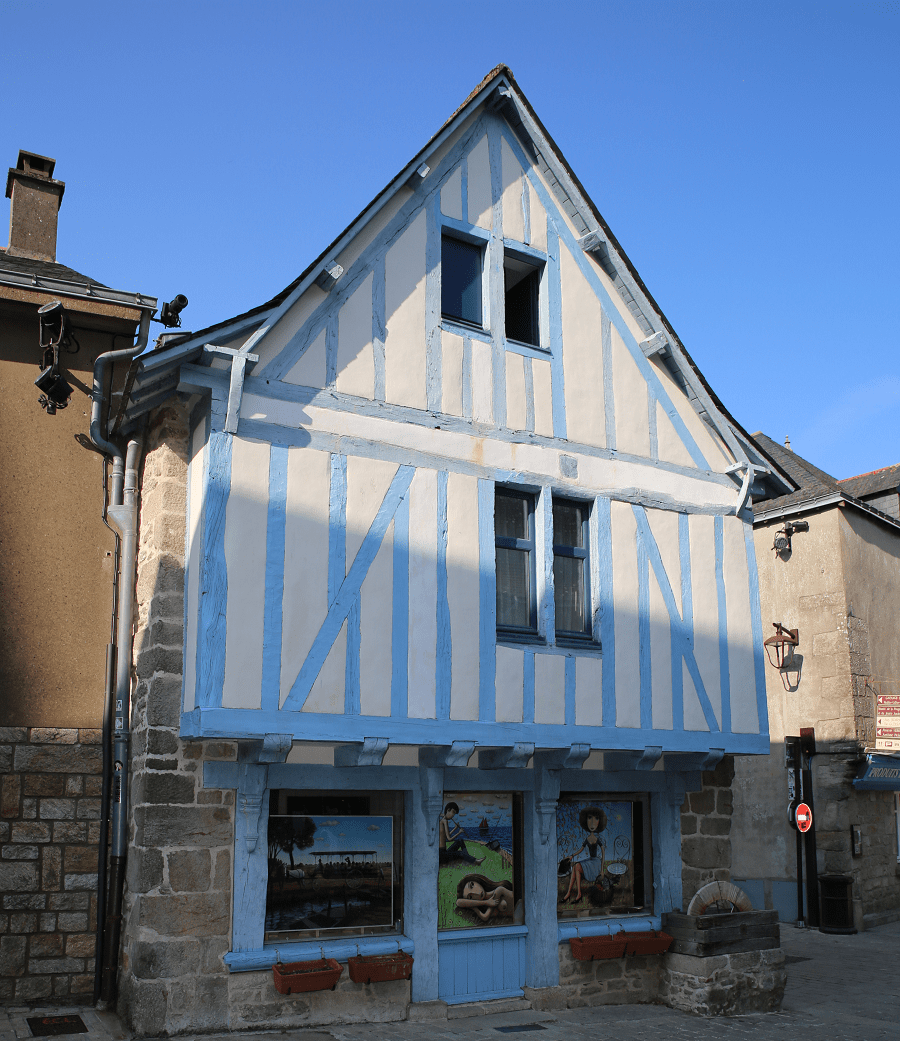
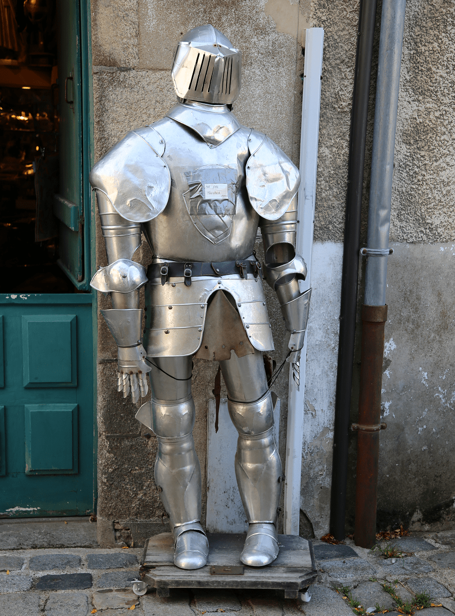
Tourism and architectural heritage
Among the monuments registered or classified by the Ministry of Culture are the first remains that man has left on the territory, such as the Sandun dolmen, the Saillé stone and the menhirs of Bissin, La Chapelle and Keroland.
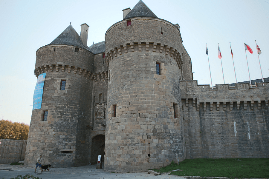
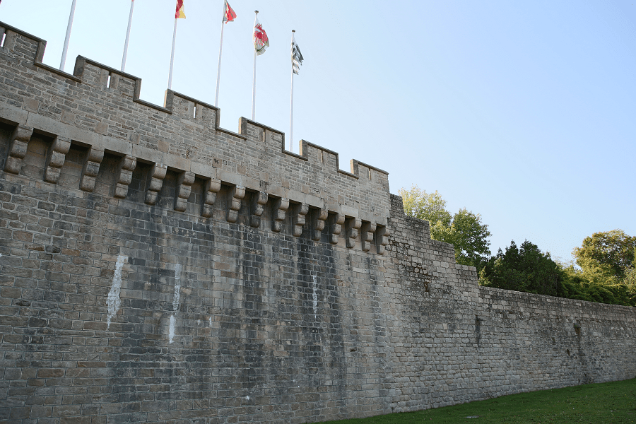
Fortified ramparts
Guérande has preserved its ramparts in their entirety. They are classified as historical monuments.

Despite the apparent homogeneity of the whole, they are the result of successive additions. Thus, near the Porte de Saillé stands a wall characteristic of the twelfth century. The Porte Vannetaise is a châtelet characteristic of the military constructions defined under the reign of Philippe II August and of the second third of the thirteenth century.
The Saint-Jean tower dates from the beginning of the fifteenth century. It reflects a first adaptation to the use of the barrel, with fitted openings, wider than those previously intended for crossbowmen.
The towers of Kerbenet, la Guadinais, Sainte-Anne and Théologale, of semi-round shape, present the particularities of the towers built in the second third of the 15th century, with their loopholes arranged in staggered rows.
The same century saw the construction of the Porte Saint-Michel, the covering of which was not completed until the beginning of the seventeenth century. It is a monumental gate, intended to affirm the prestige of the city and its identity. The town’s coat of arms is represented there, with two helmeted lions supporting the escutcheon, recalling the house of Montfort.
The curtain walls, which connect the towers to each other, are contemporary with the Porte Saint-Michel and were mostly built in the middle of the fifteenth century. Their low height is characteristic of constructions in force from the 1400s and is intended to prevent the opening of breaches caused by cannon fire. The watering tower, in the shape of a horseshoe, is intended, with its gunboats, to defend the curtain walls, according to the military models defined from 1460.
Finally, the Porte de Saillé dates from the sixteenth century.
The temptation was great to make additional openings to ensure the development of the city. If the private door of the Sainte-Catherine tower, dating from 1818, is only a timid example, the Tricot postern reflects the reflection carried out in 1850 by the Guérande city officials. It was immediately opposed by the defenders of heritage, whose approach led, in 1877, to the classification of the enclosure.
Successive restoration programs have been applied since the 1970s to guarantee the integrity of the urban wall; these measures have been reinforced since 1993 by the establishment of a protected sector in accordance with the provisions of the Malraux law of 1962.
The fortified enclosure was not the only defensive element available to the city. The mall or boulevard, built at the end of the fifteenth century or at the beginning of the 16th century, located between the Porte Saint-Michel and the Porte de Saillé for the part still preserved, constitutes a first line of defence, in reinforcement of the ramparts becoming of less and less effective with the development of attack artillery, and allows more to deploy cannons. Its current appearance is the result of developments by the Duke of Aiguillon who enhanced and transformed it into a tree-lined promenade in the second half of the eighteenth century. The moats at the foot of the curtain are then filled in.
Religious heritage
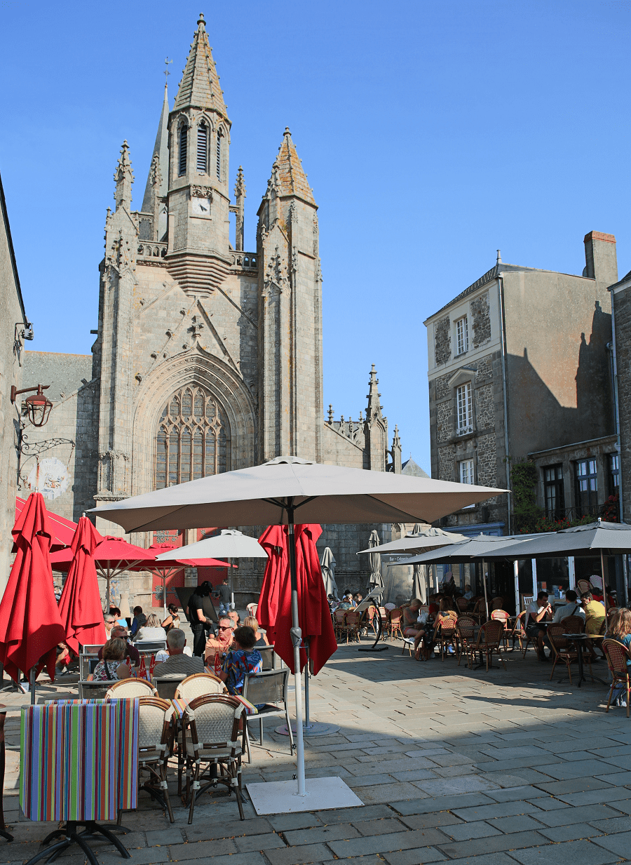
The Saint-Aubin collegiate church, located in the centre of the medieval city, has been classified as a historical monument since 1840. It dates partially from the twelfth century; This is the case in particular with the pillars and arches of the nave which resemble the architecture of Poitou. It benefits from an architectural research giving the illusion of a more elongated choir, higher and brighter than the nave, as is the custom in Brittany at the end of the fifteenth century and at the beginning of the following one.
The Notre-Dame-la-Blanche chapel was classified as a historical monument in 1910. Located near the rue de Bizienne, it was built in two successive campaigns at the beginning of the thirteenth century. It is in this chapel that the second treaty of Guérande was signed, on 14 April 1381, which re-established John IV as Duke of Brittany, the first treaty of 1365 having been signed at the collegiate church of Saint-Aubin.

The Saint-Jean chapel belongs to a group of buildings which constitutes the first hospital in Guérande and which still presents, on the Place Saint-Jean side, a two-storey building. The chapel was built at the beginning of the fifteenth century and is mentioned under the name Saint-Jean hospital on 7 June 1418.
The Ursuline convent was listed as a historic monument in 2001. Located in the Faubourg Saint-Michel, it takes its name from the nuns who settled there in 1646. They built a large winged convent structure, completed in 1704.
Saltmarshes
The salterns of Guérande is a swamp of salt water about 1 700 hectares in size. The current saltmarshes began before the 9th century and lasted for several centuries. Around the year 1500, the marshes reached 80% of the current surface. The latest were built around 1800. In the middle of the 19th century, a gradual decline started for different reasons : competition from a salt mine, lower consumption of salt as a product of conservation and improvement of transport by land. The salt of Guérande used to be traded throughout Brittany, tax free until Emperor Napoleon Bonaparte decided to tax it resulting in the beginning of a decline of salt activity.
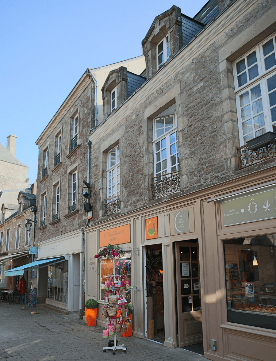
Shopping
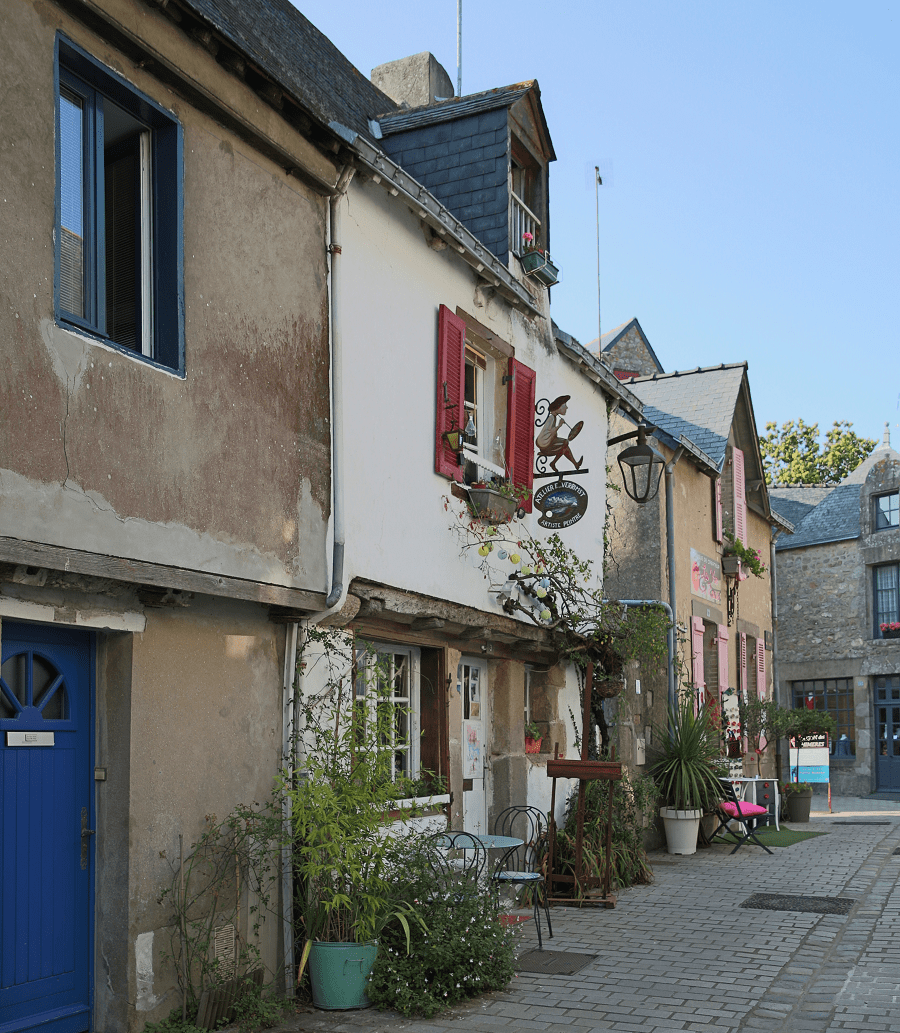
The most enjoyable thing to do in Guérande is wander around its narrow streets filled with arts and crafts galleries located inside the fortified walls.

Restaurants
There are no Michelin list restaurants in the city.
Transport and how to get to?
International travel is available via Nantes Atlantique Airport, the biggest airport in western France.
Distance by car:
From Saint-Nazaire: 22 min (19.8 km) via D213
From Biarritz (tolls): 6 h 4 min (627 km) via A63 and A10
From Dax (tolls): 5 h 40 min (575 km) via A10 and A83
From Nantes (tolls): 1 h 11 min (80.9 km) via N165 and N171
From Bordeaux (tolls): 4 h 15 min (428 km) via A10 and A83
From La Baule-Escoublac: 10 min (7.0 km) via Route de la Baule/D92
From Pornichet: 17 min (16.5 km) via D213
From Toulouse (tolls): 6 h 20 min (666 km) via A62 and A10
From Monaco (tolls): 11 h 31 min (1,243 km) via A7
From Nice (tolls): 11 h 19 min (1,221 km) via A7
From Marseille (tolls): 9 h 49 min (1,064 km) via A7
From Avignon (tolls): 9 h 7 min (980 km) via A71
From Montpellier (tolls): 8 h 27 min (906 km) via A62
From Béziers (tolls): 7 h 49 min (843 km) via A62
From Perpignan (tolls): 8 h 1 min (870 km) via A62
From Andorra (tolls): 8 h 36 min (847 km) via A62
Main information
Area: 81. 4 sq. km
Population: 15 800
Languages: French
Currency: euro
Visa: Schengen
Time: Central European UTC +1
GPS coordinates: 47° 19′ 41″ N, 2° 25′ 46″ E