


The Pyrenees (endonyms: els Pirineus or el Pirineu in Catalan, Pyrénées in French, Pirenèus in Occitan, Pireneu in Aragonese, Pirinioak in Basque and Pirineos in Spanish) are a set of ranges (forming one mountain range) at the north of the Iberian Peninsula and crossing the entire length of the isthmus that unites the Peninsula with the rest of Europe.
They extend from the Mediterranean Sea (Cap de Creus) on the east, to the Cantabrian Sea (Bay of Biscay) on the west; to the south, there is the depression of the Ebro and to the north the one of the Garonne.
The Pyrenees (in Spain) occupy the northern part of Catalonia, Aragon, Navarre and Basque Country; the southern parts of the North Basque Country (France) and Occitania (Bearn, Gascony, and Languedoc); the west and south parts of northern Catalonia (France); and the whole of Andorra. The border between France and Spain mostly follows the Pyrenees. The Basque Country and Catalonia are at the western and eastern ends of the mountain range.
The range is about 425 km long, has a width that is not greater than 100 km and has a total area of 19,000 km². The five highest peaks in the mountain chain are the Aneto (3,404 m), the Pocets peak (3,375 m), the Monte Perdido (3,355 m) (cat. Mont Perdut), the Punta d’Astorg (3,355 m) and the Pic Maldito (3,350 m).
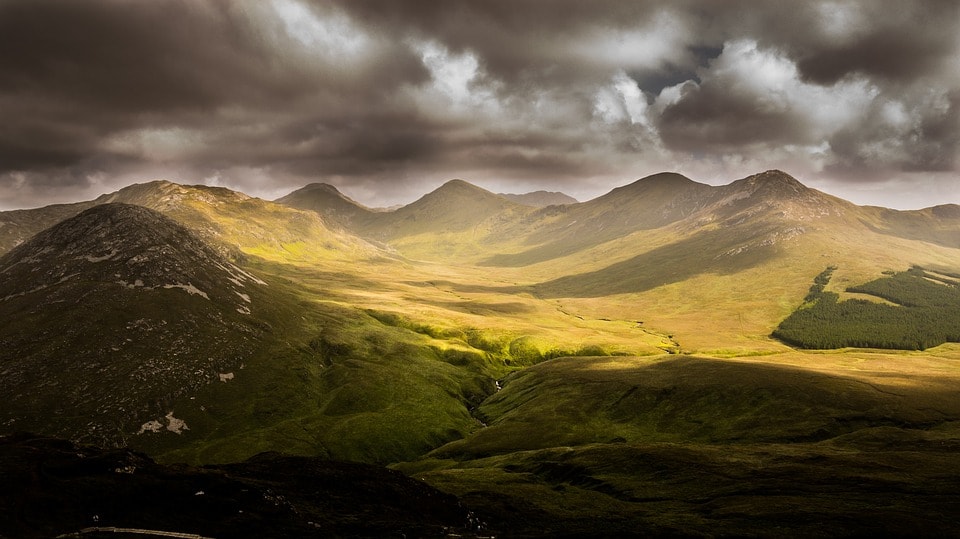
Despite its unity as a massif, it is often convenient to divide the range into differentiated areas depending on the context. According to the slope: the northern or the southern slopes of the Pyrenees; to the territory, the Catalan, Occitan, Aragonese and Basque Pyrenees; or even region: Pirineu d’Aude, Pirineu de Girona, Pirineu de Navarra. On the other hand, it can be divided in terms of altitude: the Upper and Lower Pyrenees, which form the Pre-Pyrenees (the lowest mountain ranges around the massif), or it can be divided more proportionally – the eastern Pyrenees, the central Pyrenees and the western Pyrenees. Finally, the Pyrenees are divided into climate zones of the Atlantic Pyrenees and the Mediterranean Pyrenees.
Etymology
There are many possible etymologies for the name of the Pyrenees:
- The term “Pirineus” comes from a personage of Greek mythology, Pirene (Πυρήνη). Heràcles built a tomb for Pirena giving her name to the mountain range. The word “Pirineus” was already known in ancient Greek: the term Πυρηναῖα (Pirēnaîa) appears in the texts of Plutarch.
- The Pyrenees, however, could also come from poranaia, pora (huge) and naga (mountain), a word from the ancient language of the people that inhabited the north of the massif before the Celts.
- A text that Diodor of Sicily (1st century BC) wrote says that long agopastors burnedforests that coveredthe Pyrenees. The earth wasburnt, giving it the name Pirineu, which comes from the ancient Greek word πῦρ (pîr), meaning fire.
- According to another theory, it is an Iberian or Basque ancestral toponym. In this language, the mountain range is called Ilene os (“piles of the moon”) as “Ilene” means “moon.”
Geography
In physical geography, the Pyrenees form a fairly straight and narrow mountain range and hasa total length of 430 kilometers from Cap de Creus, in the Mediterranean, to the Gulf of Gascony, in the Atlantic. The western boundary is difficult to determine accurately because the Pyrenees blend progressively with the Basque mountains between Álava and Biscay, which to the west connect with the Cantabrian Mountains and thus create a Pyrenean-Cantabrian axis of 1,000 km. The simplest, and most popularly accepted geographical definition, refers to its “isthmus” nature: a mountain range between the Mediterranean and the Gulf of Gascony, which separates the Iberian Peninsula from the rest of the European continent.
The Pyrenean valleys are typically oriented from north to south, except for the maritime extremities and some remarkable valleys such as Ordesa, Cerdanya and Aragon. This explains the low accessibility between the different valleys (the Jaca – Pamplona and Puigcerdà – La Seu d’Urgell axes are two exceptions). In addition, the highest peaks are mixed without any major depression that separates them and this explains why there are so few usable passes between the two sides.
The border between Spain and France follows the line of the highest peaks, with the notable exception of the Aran valley, which belongs to Spain but is located on the northern slope. Another exception is the great plain of La Cerdanya, which is on the southern slope but is divided between the two states (see: Treaty of the Pyrenees). To set an approximate width of the massif, it can be said that the Pyrenean foothills and pre-Pyrenees blend into the basins of the Ebro to the south and the Garonne and Aude to the north.
Geology
The Pyrenees is a variscan orogeny massif (of the paleozoic or primary era) practically swept out during the Mesozoic (secondary era) and re-elevated during the Tertiary era (Alpine orogeny), as part of the great Alpine-Himalayan folding.
In the axial Pyrenees, there are crystalline materials of the primary period (granites and metamorphic rock), while the Pre-Pyrenees is made up of sedimentary materials from secondary and tertiary periods (limestone, conglomerate, clay, marl and sandstone).
The most pronounced geological features are the asymmetry of the slopes in the transverse direction, meaning that its unevenness is much more pronounced on the north side than on the south; and the asymmetry in the longitudinal direction: the massif progressively descends to the Bay of Biscay and more abruptly to the Mediterranean.
From a structural viewpoint, the Pyrenees are different from the Alps: while the thrust sheets play a decisive role in the latter, the Pyrenees can be classified as a mountain range of autochthonous folds.
The sediments of the genesis of the Pyrenees were deposited in the coastal basins during the Paleozoic (primary era) and the Mesozoic era (secondary era). Then, in the Early Cretaceous (150 – 100 Ma), under the effect of an oceanic opening, the Bay of Biscay fanned out, pushing Iberia against the European continent and taking large layers of these sediments to ensue. The pressure and lifting of the earth’s crust made the eastern part progressively extend to the entire chain, a process that culminated in the Eocene at the beginning of the Cenozoic (tertiary era).
The eastern part of the Pyrenees is mostly made up of crustal rocks (granites and gneiss), while layers of limestone flank the granite peaks in the western part. The massive and little-worn character of the mountain range is a consequence of this predominance of crustal rocks, which hinders erosion and the creation of glaciers.

Highest Summits and altitudes
The culminating point of the Pyrenees is the Aneto peak with 3,404 meters, located between the Ribagorça and the Aran Valley. Almost all of the peaks with the elevation exceeding 3,000 m are in the central Pyrenees. In the French region of Midi-Pyrenees, in Catalonia and in Aragon. In total there are 129 main summits and 83 sub-summits above the mythical bar of the three thousand meters, divided into eleven zones.
It should be mentioned that this symbolic boundary that divides the mountains into high (more than three thousand meters) and middle (less than three thousand) is an invention of the 19th century when the French Revolution institutionalized the metric system (before the toise was the unit of measure in France).
Some of the most important peaks of the Pyrenees:
● Aneto (3,403.5 m) in Ribagorça, the highest in the range.
● The Pocets peak (3,375 m) in La Ribagorça.
● El Monte Perdido (3,348.2 m) in Aragon.
● The Vinhamala (3,298 m) in Gascony.
● The Pica d’Estats (3,143.1m), between Pallars Sobirà and País de Foix, is the highest mountain in Catalonia.
● The Comapedrosa (2,942 m), the highest altitude of Andorra.
● El Carlit (2,921 m), in the Alta Cerdanya.
● El Puigmal (2,910 m), in Ripollès.
● The Collarada (2,886 m), in Aragon.
● Pic du Midi d’Ossau (2,885 m).
● El Migdia de Bigorra (2,877 m).
● El Montardo (2,833.8 m), in the Vall d’Aran.
● The Canigou (2,784 m), in the Conflent, symbolic mountain of Catalonia.
● The two peaks of Els Encantats (2,734.3 and 2,748.1 m), in Pallars Sobirà.
● The Great Gabizos (2,692 m).
● The Pedraforca (2,506.1 m), in Berguedà.
● The pic d’Anie, divided between Occitania, Aragon and the Basque Country (2,504 m).
However, some important mountains of the massif do not reach such high altitudes: the Bugarachla peak, in the Corbera range( Northern Pre-Pyrenean), which marks the border of Northern Catalonia and Occitania, is 1,230 m and the Larrun peak, a magical mountain for the Basques, is 905 m.
Main Valleys
The Pyrenees are not a single mountain range but a set of ranges, separated by valleys, even open and flat ones, such as the Cerdanya. Other important valleys of the chain are:
● Errobi
● Baztan (Navarre)
● Orreaga
● Roncal
● Asp
● Tena
● Ordesa
● Cinca
● Benasc
● Ariège
● Noguera Ribagorçana
● Noguera Pallaresa
● Àneu
● Cardós
● Sant Nicolau
● Aran
● Valira
● Boí
● Vall Fosca
● Alt Berguedà
● Freser
● Alt Ter
● Fluvià
● Tec
● Aglí
Additionally, the valley of Aragon is a very important one for international transport. It is a historical railway axis and the current axis of heavy transport by road through the Somport tunnel.
Rivers, lakes and glaciers
This mountain chain is the cradle of important rivers. While in the north, the Garonne River starts its journey in the Aran Valley and becomes the main river of the north depression of the range, the rivers of the southern slope of the massif mostly flow into the Ebro, a river that creates the homonymous depression in the south of the Pyrenees.
North slope:
● Adur, Garona and Errobi rivers, which end up in the Atlantic Ocean.
● Tec, Tet, Ariege, Aude, Aglí and Camini that lead to the Mediterranean.
South slope:
● Bidasoa, which flows into the Cantabrian Sea.
● Aragon, Gàllec, Cinca, Éssera, Noguera Pallaresa, Noguera Ribagorçana, and Segre (all tributaries of the Ebro).
● Ter, Llobregat, Muga and Fluvià rivers which flow into the Mediterranean.
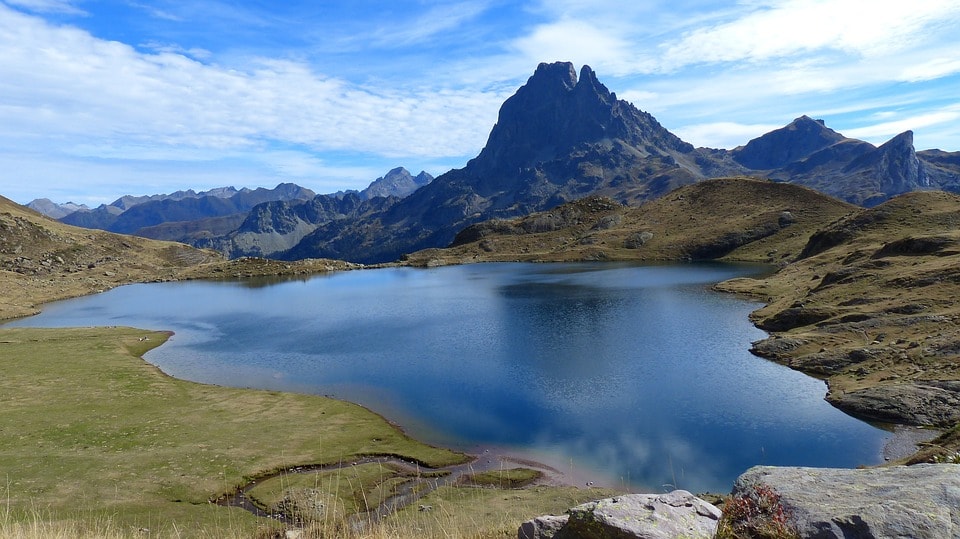
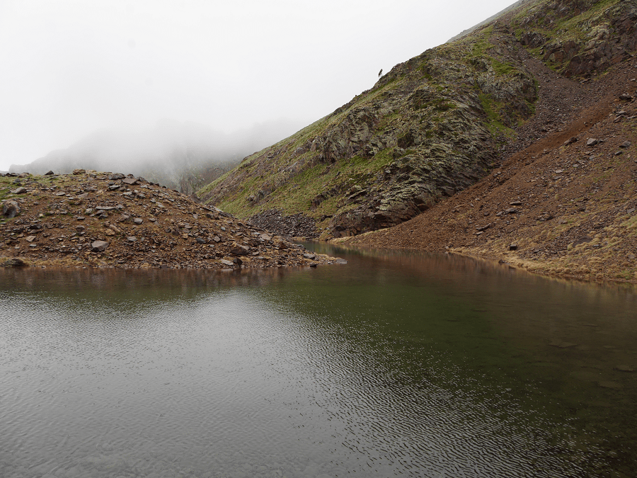
Nowadays there is no glacier below 3,000 meters and those that survive today are usually reduced to cirque glaciers: Balaitus, Vinhamala, Monte Perdido and Maladeta. The Pyrenees contains an important collection of lakes (“Estany” in Catalan, “Estanh” or “Gorg” in Occitan, “Ibón” in Aragonese) that can reach 100 meters deep. Some notable lakes are Sant Maurici, Colomers (Vall d’Aran) and others around the Bollosa (Capcir).
The Pyrenean landscape
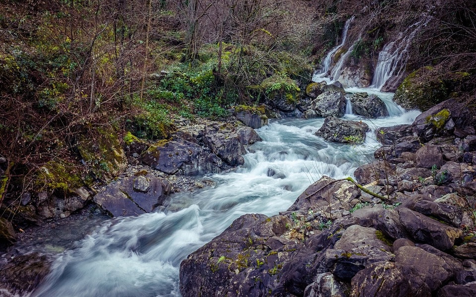
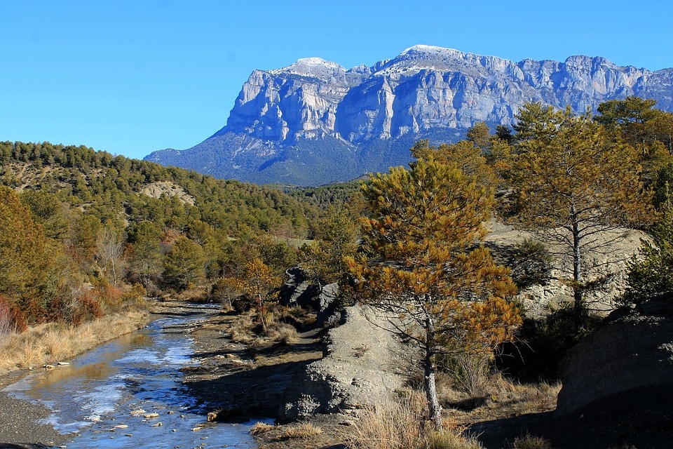
The Pyrenean landscape is typical of the high and middle alpine mountains, but there are also differences: the absence of large lakes, while the small ones are grouped in large numbers; few saddles and their high altitude; and a large number of gaves,which are torrents that fall from the high peaks as cascades, on the northern slopes. The Pyrenean cascades are one of the largest in Europe, surpassed only by those of Scandinavia and the one of Reichenbach in the Swiss Alps. Worth mentioning is also the frequency of occurrence of the cliff-like slopes forming cirque: where the bottom of the valley takes a steep semicircle shape surrounded by precipitous cliffs. Examples include the cirque de Gavarnie, Tromosa, Litor and Marcadau.
On the southern slope, the canyons abound, for example, the Añisclo Canyon, in Ordesa. On both sides, there are deep gorges such as the Montrebei Gorge or the Gorges de Carançà.
The highest waterfall in the mountain range is 422 meters tall and at the source of the Gave de Pau River at the cirque of Gavarnie. It forms part of the Mont Perdido massif on the northern slope and was registered as a UNESCO World Heritage Site in 1997.

Climate
The climate of the Pyrenees is that of mountains, with higher precipitations and lower temperatures than those in the surrounding territories. At the same time, it is a climatic frontier between the predominant Atlantic or oceanic climate to the northwest and the Mediterranean climate to the southeast (with continental nuances to the south).
There is a decrease in precipitation from west to east and from north to south. The pre-Pyrenean valleys of western Catalonia are the driest zones in the range (compare, for example, 636 mm per year in Adrall with more than 1,500 mm in the Atlantic Pyrenees). In the central Pyrenees, rainfall is moderate with regular rainfall indexes (1,000 to 1,500 mm/year in the mid-altitudes, and locally 2,000 mm at the highest peaks of the western Pyrenees) and the thermal amplitude increases ranging at 1,200 m from 0° in January to +14° in July. Right at the extreme east, rainfall increases again due to its proximity to the Mediterranean, which sometimes generates upheavals. The cross-border region between Canigóu and Olot is especially prone to intense rainfall (1,000 to 1,500 mm/year), although during the summer the drought is also common.
The oceanic influence of the northwest, from the Bay of Biscay, is intense in the Basque Country, with total rainfall reaching 1,500 to 2,500 mm/year, relatively mild winters and cool summers (average temperatures of +1° in January and +13° in July at 1,200 m altitude). This influence extends to the four-fifths of the northern slopes of the mountain range (up to Aude) and penetrates a little into the southern slope (not much further than the mountains of Navarre which are closest to the border ridge of the massif).
On the southern slope, the rainfall is essentially fueled by disruptions of southwestern Atlantic origin, which suffer continental influence during its journey through the peninsula and are reactivated at the contact with the Pyrenean relief. The precipitations are more infrequent but often more intense than on the northern slope, which explains the high number of sun hours despite having similar rainfall records (1,000 to 1,500 mm/year), except for the arid foothills (close to 500 mm/year). Temperate ocean air is rejected by high mountains, where winters are relatively cold and the summers hot (at 1,200 m: 0° in January, +15° in July).
Flora and fauna
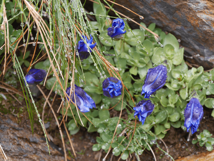
The Pyrenean flora is made up of about 4,500 species, of which about 160 are endemic. With regard to trees, it is worth mentioning the pine (Pinus uncinata) at high altitude (sub-alpine level), beech trees (Fagus sylvatica) and fir trees (Abies alba), in the medium-high mountain (mountainous level), then oaks and chestnut trees at the foothills.
Due to the mediterranean influence the eastern and southern Pyrenees are sunnier and have a different flora composition from the rest of the mountain chain. The western orientation of the east mountain range caused a large number of species that were present in the north of this region during the Tertiary era to disappear due to the cold of the last glacial period (last ice age dating from around 20,000 years ago). They “migrated” to areas of lower latitude, milder than the high Pyrenean zones, which they were not able to cross.
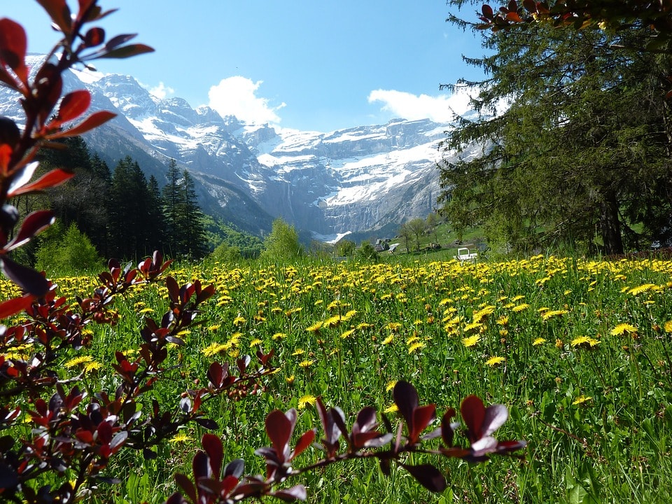
The climate is the biggest influencer on the flora of the Pyrenees. In the Atlantic Pyrenees, that is at the north and extreme west , there are green meadows alternating with forests of holm oak in the valleys and at the foot of the mountain, and beech and pine forests in the middle-high mountain. The upper limit of the forest is between 2,000 and 2,500 m (pines), replaced by subalpine heathlands (erica, rhododendron) then, from 2,500 to 3,000 m, replaced by scree, snow and small glaciers.
The medium-high mountains of the southern slope are the driest and presents a typically Mediterranean vegetation: garrigue, green beech forest, black pines, scots pine. The highest valleys include greenish meadows, beech trees, fir trees, and scots pine trees. In the highest parts of the range there would be little difference with that of the northern slope, except for the predominance of limestone lands that influence the climate and lower the vegetation boundary. Finally, in the extreme east, the torrential rains of the Mediterranean, combined with summer drought, give rise to great beech trees. It is worth mentioning the Irati Forest, considered the largest beech forest in Europe and the largest forested area in the Pyrenees.
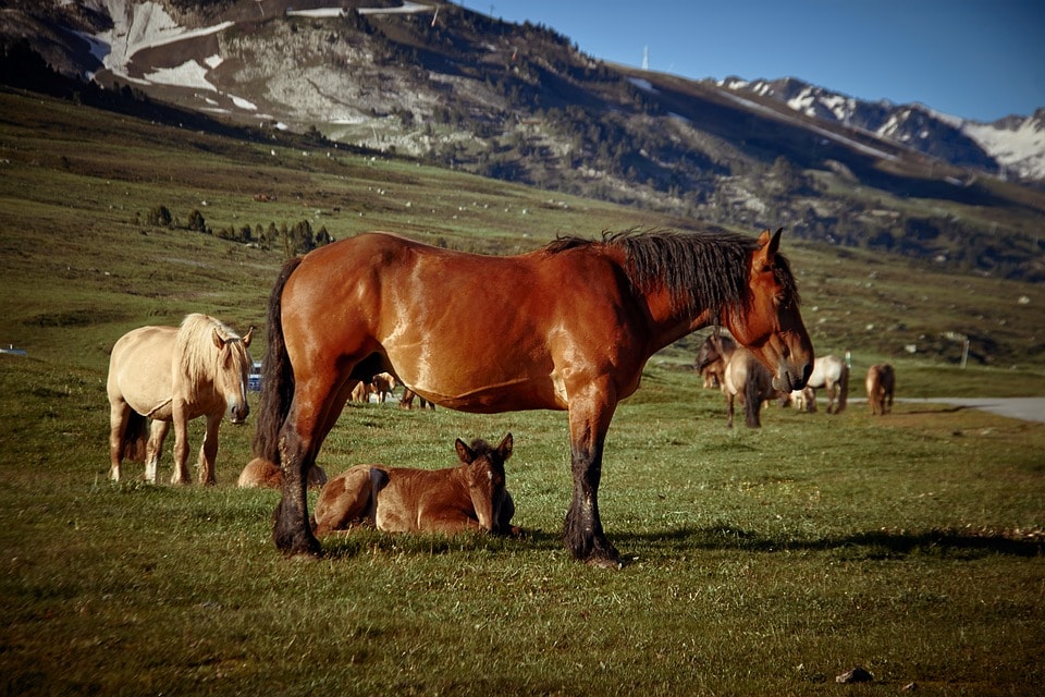
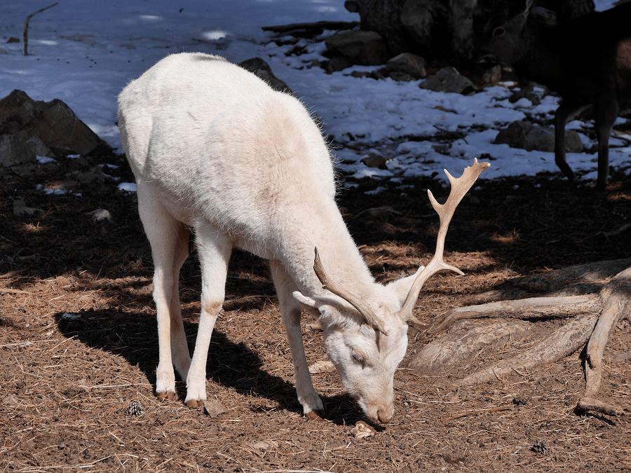
The Pyrenees is a large territory with varied climate, which makes its fauna very varied from zone to zone. Altogether 42 species of mammals exist there. In the Basque Country, the Pottok or Pyrenean horse is symbolic. Meanwhile, Brown Bear is the animal most associated with much of the central Pyrenees, although there are only few left there. Other typical but not exclusive species of the Pyrenees are: the common kestrels, marmots, wild boar, chamois, wolf, deer, iberian lynx, eagle, falcon, etc.
Some endemic species have already been extinct, such as Pyrenean goat or ibex, the latter mysteriously extinct between 1998 and 2001.
Among the nearly 200 species of animals that subsist there, some, such as the Brown Bear, hunted almost to extinction in the 1990s, was reintroduced with bears from Slovenia in 1996. Their timid presence can already be seen in the Vall d’Aran and Andorra. Some other species on the brink of disappearance have been revived, like the isard, which at the beginning of the 19th century was on the threshold of extinction and now has 45,000 specimens.
Among the birds, the undisputed king is the bearded vulture, extinct in almost all of Europe, it is estimated that there are 500 to 600 left. Other birds in the Pyrenees are the royal eagle, bee-eater, red and black kite, the falcon, the common kestrel, the pyrenean owl or the very rare boreal owl, as well as the griffon vulture, the egyptian vulture and the black vulture. Additionally the wood grouse, in clear danger of extinction on the southern slope (4 males in Navarre, 75 in Aragon and around 450 in Catalonia), is actually well conserved in the north (about 3,500 males). In the high mountains lives one of the Pyrenean jewels, the ptarmigan, with 700 pairs.
Endemic wildlife of the Pyrenees include: the Pyrenean Cow, the Pyrenean Sand Lizard, the asp viper, the Pyrenean newt, the Gerbe’s vole, Bruna dels Pirineus, the Pyrenean Mountain Dog and Pyrenean desman.
Natural parks and reserves
The fauna and flora of the central Pyrenees are protected by three national parks: the Pyrénées National Park, the National Park of Aigüestortes and Estany de Sant Maurici and the National Park of Ordesa and Monte Perdido. Additionally there are national nature reserves in the north-western Pyrenees such as the Néouvielle, the Aussau valley, the Pocets-Maladeta Natural Park and the Alt Pirineu Natural Park in the south-eastern zone, and also the Cádiz-Moixeró Natural Park.
Also, there are numerous North-Catalan nature reserves like the ones of Prats de Molló, Noedes, Pi de Conflent, Mentet, Vall d’Eina, Jújols, Conat, La Maçana; and the Catalan nature reserves of the high valleys of Freser and Ter, and Albera. Finally there are the regional nature reserves of France: Ariège (Embeyre), Northern Catalonia (Nyer) and the Alt Pirineu (Pibeste). The numerous natural areas classified by law to protect the landscape, the biological reserves, and the wildlife reserves, all bear witness to the ecological importance of the Pyrenean massif.
Transport
The transport of the Pyrenees is based around two facts: it is a rock massif that clearly divides the Iberian Peninsula from the rest of Europe; and you have to overcome it. All commercial, public and private transport going between Iberian Peninsula and the center of Europe must pass through the Pyrenees, or go by boat, but that is often expensive and not convenient. See here more about transport system of the Pyrenees
Economy and tourism
The main sources of income in the Pyrenees are tourism, especially in Andorra, the Aran Valley and the Cerdanya, as well as livestock and other agricultural activities. The tourism in the Pyrenees is, in general terms, alpine tourism based on winter sports, especially skiing, but also hiking, ecotourism and rural tourism in general.
However, some places have additional attractions to nature or ski resorts. The Boí valley has a group of Romanesque churches classified as world heritage site. In Andorra, the Madriu-Perafita-Claror valley also has this distinction, as well as a very popular Romanesque route. Prada and Northern Catalonia use their cultural particularity as a tourist attraction, and so does the Iparralde. Conflent and Cerdanya main attractions are their tourist Yellow Train (Tren Groc), and the citadels of Montlluís and Vilafranca, which are also a World Heritage Sites. Lourdes in Gascony, is a world pilgrimage center. See here full travel guide of the Pyrenees
Cross-border economic regions
Being as much a crossing point as a border, the Pyrenees host a number of cooperation or community projects that group areas on both sides of the Spanish-French border:
● Basque Bayonne-San Sebastián Eurocity
● Pyrenees–Mediterranean Euroregion (l’Euroregió Pirineus Mediterrània), created in 2004
● The Catalan Crossborder Area (l’Espai Català Transfronterer) between Northern Catalonia and Girona (in project)
● La Xareta, a region and community of services of two villages of Navarra and some Lapurdi villages.
Human presence
Prehistory
The first documented human presence in the Pyrenees is found in Bauma Margineda (Andorra) dated to the Epipaleolithic period, the same place also documented the occupation during the Neolithic periods and the Bronze age.
The presence of Iberian tribes is cited in ancient sources: Bebrics in the central Pyrenees, Iacetans in the Aragonese Pyrenees, Cerretani in Cerdanya, Andosins in Andorra, Airenosis in the Aran Valley, Castellanis in Ripollès. It is possible that the Basque were also present.
● 9th century BC: the Celtic tribes, from Central Europe, enter the Iberian peninsula through the Pyrenees, where they settle, becoming Celtiberians.
History (Ancient and Post-classical)
● 219 BC: Hannibal crosses the Pyrenees on his way to Rome. He was finally defeated.
● 133 BC: The Romans arrive in the Iberian peninsula during the Second Punic War. Little by little they extend their influence with military campaigns and the construction of new Roman cities. However, this invasion mainly affected the Mediterranean coast and valleys, in the Pyrenees the introduction of Latin culture was slower and less obvious. Finally Iberia was romanized, and started to be called Hispania. The Roman provinces that encompass the Pyrenees on both sides are to the east Autrigonia and to the west of Tarraconensis. For a long time, the Basques are free from the Roman domination, if not from their influence. See here more history of the Pyrenees
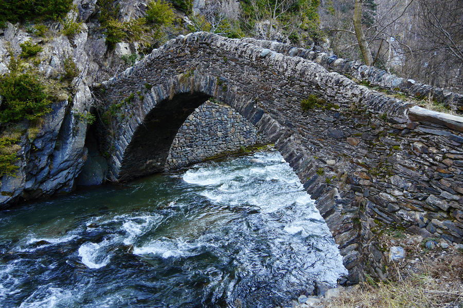
Pyrenean architecture
The climate and diverse cultures that occupied the Pyrenees have generated a distinct architecture. As a cradle of nations (the Basque, Aragonese, Occitan and Catalan), it conserve the oldest constructions of these towns, often as a result of the distance of the mountain range from the main centers of modern cities and the scarcity of urban pressure. Many of these constructions are protected as regional, national or, in some cases, world heritage sites.
Among the Pyrenean architectural heritage, there are:
● Hórreos, typical construction of the Basque Pyrenees (especially the Aezkoa valley) used as an outer pantry or granary. It has the shape of a house raised on four pillars to keep the food dry.
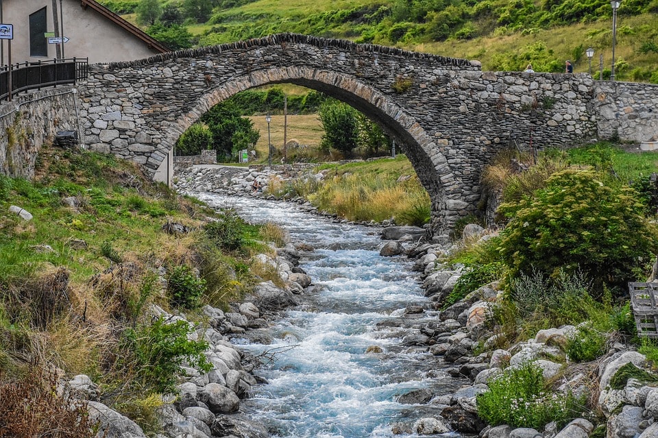
● Mountain huts (refugis), from the humble ones made with dry stone to the modern complexes such as the one in Núria valley. Originally they were shepherds shelters, now best known in reference to hiking and nature parks and reserves, where the government is responsible for their upkeep.
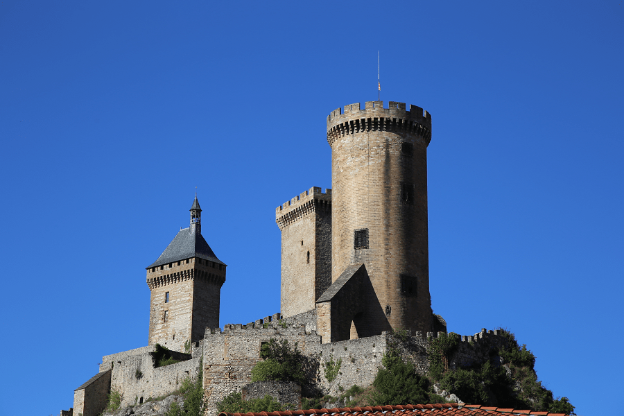
● Military buildings: Castles are a typical structure throughout the peninsula, especially in the Pyrenees. Where good examples can be found, such as the Cathar castles, the Casa de la Vall in Andorra, or the castles designed by Vauban in the 18th century.
● Civil buildings: Some stand out for their modernity. Examples include: the Caldea spa in Andorra, the Canfranc Station in neoclassicist style and the totality of the Pyrenean railway heritage, which is in the process of restoration.
● Religious buildings: The Pyrenean mountains are full of Romanesque and even pre-Romanesque churches and hermitages almost in every valley and summit. The outstanding Romanesque churches of the Vall de Boí are a world heritage site. The sculpted portico of the monastery of Santa Maria de Ripoll is considered the best example of Catalan Romanesque style, it is a work of the school of Ripoll, which has designed or influenced most of the Catalan-Pyrenean churches. Worth mentioning is also the sanctuary of Lorda, a pilgrimage center.
● Monuments: The Cromlechs, megalithic monuments of pagan worship, stand out.
See here more architecture of the Pyrenees
Mythology
According to Greek mythology, Heracles created the Pyrenees, when gathering stones to bury Princess Pirena. According to geology, they formed in the Tertiary Era, with the alpine folding.
The Pyrenees are a very suitable ground for the creation of tales and legends of fairies, monsters and heroes. There are many rocky formations, that due to their strange form, have sparked all sorts of stories around them. Likewise, the wild and immense forests and rivers, and the unpredictable and drastic weather, gave the nature (and its agents) strong mystical powers in the beliefs of the natives.
The mountain range was a place of human passage from prehistory, but at the same time it was a place isolated from population centers. This has delayed the advance of the Christian religion and in general, of modernity. In the area, there is evidence of very ancient cults, for example the Chryslerch of Donibane Garazi, as well as local gods. The pagan deities lost strength in favor of fantastic figures that did not clash with the Christian culture. These figures were especially important among the shepherds as protection from evil. In this way, the pre-Christian superstition simply linked with the newly arrived Christianity. Legends were created which incorporated the Christian trait of a strict and judicial God, but did not stop using the traditional characters such as giants and follets (catalan mythological character). As an example, in the Catalan Pyrenees there is the legend of the Encantats (cat. the enchanted ones), two hunters who skipped the mass in search of a chamois and as a punishment were transformed into stone.
In general, we can talk about tales of giants in the central and eastern Pyrenees, lamias (fairies) in Basque Country, minairons (Catalan fairies) and witches in the lower ranges. The witch is a symbol of many villages, and in Zugarramurdi there is a museum of witches. The same mysticism turns many mountains into gods or spirits, such as the Puigmal or the Aneto. There is also a large number of enchanted rivers and forests, as well as inhabited by spirits, goblins or other creatures.
Although most of these legends surely come from prehistory, it does not mean that there is no new ones. Like the story of Roland’s Breach (Bretxa de Rotllan), a mountain pass supposedly open with a cut of a sword by Roland, which is rooted in a real story of the battle of Roncesvalls in 778.
To this day, the pagan festivals have a strong significance in the Pyrenees, such as the Saint John’s Eve (Nit de Sant Joan) or the Falles del Pallars.
Languages of the Pyrenees
The Pyrenees form territories of three states (Spain, Andorra and France), there are four languages of Pyrenean origin (Catalan, Occitan, Aragonese and Basque) and five that are official (Catalan, Occitan, Basque, Spanish and French). The mountain range receives the following names in the languages of the territories it occupies: in Catalan «Pirineu» or «Pirineus»; in Aragonese «Perinés»; in Basque «Pirinioak»; in Occitan “Pirenèus”; in French «Pyrénées»; in Spanish «Pirineos».
Catalan language is official in Andorra and co-official in Catalonia (but not in Ribagorça or Northern Catalonia, although it is spoken there.
Spanish and French are official languages on the southern and northern sides of the Range respectively.
Basque is co-official in the South Basque Country, but not in the North Basque Country.
Occitan is co-official in the Aran Valley.
The only Pyrenean language that does not enjoy official status, in any territory, is Aragonese, spoken throughout the Aragonese Pyrenees but without its own legal status.

